Some news for a sleepy Monday:
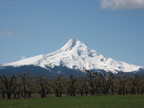
Mt. Hood in Oregon.
- The ash from Eyjafjallajökull is, once again, causing significant airspace closure over northern Europe - close of 1,000 flights today. However, much of the closures are fairly short-lived, but that isn't keeping people happy. The eruption hasn't actually changed much, just that the winds are bringing ash towards Europe. The ash for the next few days will likely effect the England, Scotland, Ireland, Netherlands, France and possibly other parts of northern Europe (along with airspace over Greenland and the north Atlantic). The ash plume is reaching upwards of 7-9 km (24,000 - 30,000 feet) with significant lightning in the plume (over 150 strikes/day). You can check out an amazing video of the eruption - up close and personal.
- There is a brief report of a eruption and avalanche at Mikeno in the Democratic Republic of the Congo. Mikeno doesn't even muster a description in the Global Volcanism Program database, so not much is known about the volcano beyond its location 45 km north of the city of Goma - and the large population of mountain gorillas on its flanks. The unconfirmed eruption at Mikeno has reportedly left 36 people missing after the avalanche.
- Remember, tomorrow is the 30th anniversary of the eruption of Mount St. Helens - and if you haven't already checked out the eruption memories of Eruptions readers, you should! There is a lot of articles marking the anniversary about the eruption, the volcano and the recovery.
- And while all this is happening marking the 1980 eruption of St. Helens, there is a report of a small earthquake swarm at St. Helens' neighbor, Mt. Hood. In fact, the USGS reports that a series of small earthquake swarms have been occurring at the Oregon volcano for the past month. These swarms are relatively common, but are still worth watching. Hood's last confirmed eruption was in 1865-6, possibly as recently as 1906.
- Log in to post comments
Looks like the weather is to be good for a few hours this evening but then it turns nasty until friday so get your webcam fix in now.
Indeed a huge dark ash plume is visible on the Hvolsvöllur webcam:
eldgos.mila.is/eyjafjallajokull-fra-hvolsvelli/
Not looking forward to an eruption of Mt. Hood. I know it will happen someday, but when it does I hope it is small, interesting and brief :)
I was at a weekend wedding on Mt. Hood a couple of years ago when a 3.5 earthquake startled us all in our beds early in the morning. We jokingly talked about it being a bad omen for the marriage. Unfortunately, we were right...
In fact Boris, you´ll see the plume better from Mulakot cam, when it´s not overexposed, that is ;)
http://www.mulakot.net/images/myndavelar/14flugv.jpg
Good evening! I wonder why stratovolcanoes in Iceland don't show the classical cone shape, like Fuji, Osorno or Mayon. Is it because they're mostly under glaciers? Etna is another example; why? Because of so many fissures growing into scoria cones on its slopes?
5) Correct, most are buried under glaciers. Also the Mid-Atlantic rift runs through Iceland. I believe the island nation is gradually splitting apart, so the volcanoes are very productive lava/magma producers, plus the fissure systems are different than the typical stratovolcano, having long and large fissures and calderas.
Eyja is playing hide and seek
sometimes I can sneak a peak
behind the clouds and see a streak
of heavy ash clouds like a beak...
of a bird, or a trunk of an elephant or a shoe
imagination makes it true!
#6 Thank you Robert!
To Boris: I read somewhere (I think in a French newspaper) that you would need 3 weeks, in the best of cases, in order to evacuate the 600.000 people threatened by Vesuvius, if it was to undergo explosive activity. Is it true? How are the emergency plans in Napoli? I was there last year, and thought it was quite a nightmare regarding traffic; I dare not imagine what it would be like in case of re-awakening of the Vesuvius or the Campi Flegrei...
Update on Activity IMO 17th May 2010 18.05
The height (a.s.l.) of the eruption plume is about 6-7 km according to radar, occasionally pulsating to 9 km (27,000 ft). Winds around the volcano are slightly increasing, resulting in lower plume height. The plume is drifting east and is dark-gray.
Ash has fallen in the Gnúpverjahreppur area, on the road to Sultartangi power station and in the Biskupstungur area (very fine particled and gray). The eruption site has not been visible today. Constant lightning has been detected, up to 10 flashes per hour. The ash plume rises straight up from the site.
The volcanic activity is explosive, but there are indications that it has somewhat lessened since the maximum on 13 May. Considerable ashfall is in the nighbouring communities and is expected to continue. Fluctuations in the strength of the eruption and in ashfall can still be expected.
Details in status report issued collectively by the Icelandic Meteorological Office and the Institute of Earth Sciences at 17:00.
there may be trouble ahead, but whiles there,s "moon-light" love and romance, lets face the music and dance.
I was tempted to click on this banner link:
http://scienceblogs.com/worldsfair/2010/05/introducing_the_science_scou…
I'm glad I did, because the Science Scout Badges have a very high BTSSB rating, IMAO. (BTSSB = Best Thing Since Sliced Bread.) And here is a nice TBUSLA (Totally Brewed-Up Six-Letter Acronym) in the post as well. Definitely a gem.
Just a bit of news from another volcano that is erupting, though not with such exuberance as Eyjaf. The web cam that was placed on the edge of Pu'u'oo crater is no more. A part of the rim fell into the crater and took the camera with it. Oddly enough, the camera landed upright while the tripod is in pieces. A new camera has been placed on the north side and will be online soon. I wonder if more will be seen in there now. Probably not. But once in a while, the wind will give us a peek into Pu'u'oo to see some of the changes. My DH and I used to watch that cam to see what was going to happen on the floor of the crater. That was before the TEB opened up and the lava in the crater started gasing out. I watch this volcano and I know I will go back to it more often when Eyjaf stops. That may be quite a while.
Thanks for the update Ruby.
@Irna #9. You're touching very hot ground here :-D
There is an emergency plan that was prepared by the Italian Department for Civil Defense and volcanologists already 15 years ago and revised recently. This plan assumes that two weeks will be enough for a coordinated and orderly evacuation, and that the volcano will give at least two weeks of warning before erupting catastrophically.
That's tricky indeed, because (a) you noted correctly that traffic (and not only traffic) in the Vesuvius-Campi Flegrei area is hilariously chaotic on any normal day, (b) even if it were possible to carry out a coordinated and orderly evacuation of at least half a million people, it is not certain that Vesuvius (or Campi Flegrei, at that point) will erupt on schedule. I never cease to cite the example of Redoubt in Alaska last spring, which seemed to be about ready to erupt in late-January but erupted only in late-March, that is, two months later. Two months of delay in the case of the Naples area would bring a social, economic and political crisis of dimensions hitherto unseen in Europe, and would require an entirely new generation of volcanologists ;
@Boris, when does a volcano ever erupt on cue? LOL
@Reynir12 - andif you follow a bit futher you will find http://www.scq.ubc.ca/sciencescouts/the-active-volcano-is-my-research-l…
I think these are all fictitious and not for sale....but maybe not, in which case they might design a specific Eyjaf one, proceeds to help all researchers on this blog!
Is it common for volcano's to produce "mini tornado's" ?
The first time a few days ago on the Mulakot cam i saw one traveling beside the mountain slope.
First thinking it was just dust being blowed away.
But at this moment on the Thoro cam a saw a few already,
every time developing on the right side in the camview.
(on the sandbanks) it begings with a very visable white dot, getting a little bigger and then traveling beside the slopes. If you look carefully you will sometimes see a white thin line going all the way up into the clouds.
Hmmm. Birdseye, you may be on to something there. An Eyjaf patch would be cool, especially with the full name on it. :-)
Better updates now at Iceland Met Office with interesting animation of ash cloud.
http://en.vedur.is/earthquakes-and-volcanism/articles/nr/1884
@Franklin #18 I think what you are seeing are "dust devils" - http://en.wikipedia.org/wiki/Dust_devil
@DianeNCa But it would have to have a reference to Erik's blog...maybe the basic URL? : )
I see the GPS measurements are back and it looks like she's inflating again.
@Diane #16, luckily some volcanoes have erupted more or less on cue, think of Pinatubo or Rabaul ... there are quite a few cases of this kind. But all of these occurred in countries where living standards are significantly lower than in Italy, and tens to hundreds of thousands could be evacuated without posing too much resistance. That would be more of a problem here, where nobody would want to leave their homes with the five or six super-HD television sets and the computers and the new refrigerators and microwaves and laundry machines and the second and the third car and so on. So the volcano erupting on schedule is only one facet of a multifaceted challenge ...
Birdseye #22, perhaps we could have a general looking volcano or it could be Eyjaf and something like "Eruptions Blog on Eyjaf" or something like that. There is limited space so maybe others have an idea, too. It would be neat to have something like that to commemorate the eruption and this blog, too. It would take a lot of work to set up, though.
Thanks SUW, that's exactly what i saw ;)
They are short lived 30 sec to 1 minute.
The second picture (Wiki) are the ones i saw.
Only difference is that these (camview)are very white??
Maybe a trick of the cam.
No more scratching my head now.
Nice to meet you "Dust Devil"... :)
I'm sure it's not so, but on the Thorlsfelli cam it looks like a smooth brown lake has formed where the old lake used to be. It's likely just a combination of the poor lighting and the low resolution.
I'm curious to know if people are able to get house insurance if they live aroung Pompeii or Vesuvius ?
Eruption in Eyjafjallajökull
Status Report: 17:00 GMT, 17 May 2010
"Heading: The plum is drifting east." :)
On a more conclusive note:
"Earthquakes: Six microeathquakes have been recorded since midnight. Most of them
occurred at depths of more than 10 km.
GPS deformation: Continued horizonal displacements towards the center of
Eyjafjallajökull volcano and subsidence."
----------------
It ain't over till it's over OR It ain't over 'til the fat lady sings ?
notendur.hi.is/runa/eyja_gps.html
Zander, they probably can, baring any volcanic eruption. I suppose they might be able to get volcano insurance like CA can get quake insurance, but it would cost a lot and would probably have a large deductible.
Boris?
@Birdseye #17: A whole bunch of volcanologists could take that design to their local custom badge sewers.
Still shots from the Vodafone cam are accessible through yesterday afternoon via direct URL. If I am interpreting the date/time parameters in the URL correctly, they stop at 2:59 yesterday afternoon. You can manually enter earlier values for the timestamp and date and see photos from over the weekend when the live cam wasn't accessible. (Someone tell me if I've got this wrong.)
extras.vodafone.is/trailers/fimmvorduhals/mx10-4-235-80/2010/05/16/14/59.jpg
@Frankill - sorry I misspelt your name! Too tired this evening to be coherent!
@carla yeah, the cameras sometime looks like there's a new lake, but there isn't! there's nothing to plug the hole in the moraine!
Slightly OT www.nytimes.com/2010/05/18/science/space/18cosmos.html
Someone like me who has managed internationalization and localization for a large corporate website should be more precise when talking about time to an international audience. The pics mentioned in #32 run through 14:59 (2:59 pm) yesterday. ;\
@Boris 15
Thank you for the answer. Two weeks, that's slightly better than the three weeks I had heard of, but still frightening. Moreover, I can't imagine half a million Napolitan people in a "coordinated and orderly evacuation" :-). But then, I cannot imagine it in any other place either, with a volcano like Vesuvius in the background...
@Carla #35: The images are timestamped in one corner. Image time is about two minutes behind real time.
Has the Mila Thoro cam been moved to the right slightly, I know there is alot of ash and what looks like mud on the lake bed but I am a bit confused, I have been watching the cams everyday for weeks now and........oh I'm not explaining myself very well, someone just go and have a look and tell me what they think please
Gan someone explain the light area I see on the Thoro cam right now?
@ Suw33 haha Funny, I didn't even noticed it...
I make typo's all the time :)
@Carla27 The lake doesn't travel a km....
visibility was good at the time.
And i do have high resolution (better than Thoro)snapshots of them and some are big....and crystal clear.
It has nothing to do with limited or faulty cam conditions.i'm sure some one else must have seen them too.
@Ruby - it's in the same position but there's a lot of light-play tonight, especially that brilliant white blob which also shows up on the Mulakot cam (and was on the Hvols cam until a few minutes ago).
Memo to Mila:
Please focus your Thoro cam.
Thanks in advance.
@Frito Thank you I think you are right its the way light is falling, playing tricks with me hah I was starting to get disorientated I like it kept just the same position so I can notice any small changes going on. Panic over now lol
@Carla and Frankill or anyone ~ do you guys remember seeing what now looks like a huge white cliff on the left side of the lake?
@Ruby ~ don't laugh, but for the first week or so I was using those little post-it flags on my monitor to mark positions :)
@40 - Frankill, not sure what you are referring to. Perhaps you thought I was responding to something you posted earlier? Anyhow, my comment was not related to anything. I was just remarking about the faux lake on the Thorolsfelli cam.
and ... my trusty post-it flags tells me she's cranking it up a notch :)
I don't think the "white cliff" has changed. that is the lateral / terminal moraine for the glacier. I think that it is due to the low sun picking out the vertical face while the geround level is in deep shadow from the other side of the moraine. The same colour can be picked up on the outside wall of the other side of the moraine and along the base of the EF massif.
@Frito I'm not laughing I think thats a great idea, now why did I not think of that :)
@Gordon ~ thank you. The visuals this afternoon on the various cams sure are stoking our imaginations.
Reef. Thoro cam, I think someone metioned a few threads ago that the problem for Thoro cam is with 'flash' (something to do with the server, someone had else better explain) rather than with the camera itself.
Imagination.. see 7 above... :)
@snotraviking ~ saw that earlier, love it!
I have a question re Icelandic names. If a Freddottir marries a Barneyson, what is her last name?
@Carla40 i was refering to nr26 & nr27.
Youre answer came right after my post.
Sorry fot that one :)
A little bit confused with all those Devils i supose :)
@princes Frito43 :) Think it's still the same. A little more dust and the sun playing arround.
I think there's a rainbow coming up right now.
Frito, re 52, that's a question just begging for a punchline... Shame I can't think of one just now.
@frito As I recall, an icelandic girl don´t change name when getting married, And their phonebook is sorted by first name too.!!! At least this was true 1989 when I lived there.
Hvols cam looks stunning at the moment I'm not really into art but if someone where to paint me a picture of what it looks like right now I would definately hang it on my wall, the colours of the clouds and the ash plume in the background along with the landscape are spectacular
Has anyone heard anything else about the lava flow at Eyafjoll moving in the north as well as on the NW Flank? I heard one blurb about a week ago and nothing since. I hope that it stopped, because a lot of folks live on that flank.
Thanks to all providing photo's, i can not take any, and the one's posted here are incredible.
@Ruby I agree and was going to post the same thing but instead was struggling to open my MWSnap program to capture it. Awesome stuff today :)
@snotraviking Thank you. And if they have a son? Daughter? What would their last names be?
"8. ... It is forbidden to take a new surname in this country.
9. nationals can not take the surname of their spouse."
From Google Translate of ...
www.althingi.is/lagas/135a/1996045.html
Just looking at info concerning Mt Hood, seems this one is really not known for major explosive eruptions, but its lahars would be wicked. Lots of ice up there. Really bad news for Portland and the surrounding area when this one wakes up. Just a matter of time.
@birdseye #50: Can't remember who it was either, but (s)he e-mailed to ask and got the reply that the Flash server (I suspect it encodes and serves Flash video to the masses) was being troublesome. For all I know (sod all, btw), there might be a bandwidth shortage, too.
@Frito #52: She remains Fred's daughter, he remains Barney's son.
There is a really interesting change in viewpoints between Mulakot and Hvolsvelli just now. Mulakot showing ashfall from column very clearly.
Incidentally, did anyone see the bus stopping at Mulakot about an hour ago?. It's the first sign of life I've seen in a month.
Lesson in icelandic naming:
Mom Hildur Thorsteinsdottir and dad Thorgeir Baldurson gets a son who they name Haraldur Thorgeirsson. He gets his fathers first name + son. I don´t know what will happen if the father is unknown, maybe he is called Hildurson. A daughter would be called Thorgeirsdottir in surname.
Son is the same in english of course, dottir is daughter.
If I got it wrong, please correct me, I am scandinavian but not icelandic and my surname is neither -son nor dottir.
@Reynir ~ Thank you. So as I understand it:
Ms. Freddottier and Mr. Barneyson's girl and boy would be Pebbles Freddottir and Bambam Barneyson respectively?
@cynthia #57 ~ I haven't heard much about lava flowing since May 10th when it was "low and not visible on cameras".
Here's a link to IMO's daily updates:
//en.vedur.is/earthquakes-and-volcanism/articles/nr/1884
interesting image on
http://www.mulakot.net/images/myndavelar/14flugv.jpg
is it a trick of the lighting or ?
So...
Ms. A. Bdottir and Mr. X Yson' girl and boy are:
Miss C. Adottir (or C Xdottir, after the father?)and Mr. Z Xson?
Ms. A. Bdottir and Mr. X Yson' girl and boy are:
Miss C. Xdottir, after the father and Mr. Z Xson
Now you´ve got it right Frito. You shold really see a family tree from an icelandic person...interesting stuff.
Before the ash and fog came kicking in yesterday morning I made two timelapse movies from the Vodafone and Múlakot webcams:
http://www.youtube.com/watch?v=O_NuBcOht4E
http://www.youtube.com/watch?v=1Qjm3UvgdvM
The Múlakot one is quite overexposed unfortunately...
@Frito #64: Vala (Pebbles) would have been Fredsdóttir up here and Bammbamm would'be been Barneysson. Now, if those two married and had kids, the daughter would be Bammbammsdóttir and the son would be Bammbammsson. Y'see, they are not surnames but patronyms.
I've been looking for the author of a poem quoted earlier in the previous EF oreintated post, I thought it might have been by Rudyard Kipling, but haven't found it so far.
I did find this however, it's original context seems to lie in pre WW2 politicking, but I think it describes the community here quite well (feel free to disagree!)
WE KNOW the Rocketâs upward whizz;
We know the Boom before the Bust.
We know the whistling Wail which is
The Stick returning to the Dust.
We know how much to take on trust
Of any promised Paradise.
We know the Pieâlikewise the Crust.
We know the Bonfire on the Ice.
@pierre, Thank you for the time-lapse movies. What´s the music on the vodafone cam, (composer and piece). Good combination with that and the timelapse. LIKED IT!
VERY NICE PIERRE.... And the composer on the first piece?
@Reynir, snotraviking, raving: Thank you! Patronyms is the key! Yes, the Iceland phone directory must be quite interesting!
Maybe as well that the camera on Valahnúkur is offline. We don't have to watch it drown in ash, then.
#73: Yes, to those unused to the ordering keys being 1) First name, 2) Patronym, 3) Middle name(s).
#71, I think it is Mozart, horn concerto in E-flat. Whenever I hear this piece I think of the words that Flanders and Swann put to the piece sometime in the sixties.
http://www.nyanko.pwp.blueyonder.co.uk/fas/anotherhat_ill.html
Looked at a science show today on the TV- they claimed that if Katla erupts she is so much more powerful than Eyja that the ash could reach the whole northern hemisphere. They also said that telephone connections could be affected. Can anyone explain to me how that would work?
Indeed, the piece on the vodafone timelapse is from a Mozart horn concerto (concerto no 4, K.495) ;)
#78: Happens to be one of my favourites. Another is the 2nd mvmt from clarinet concerto K.622. And that includes Hooked On Classics.
Question : I watched the video mentioned above and I am thoughtful about the volume of magma ejected every second by this volcano. Indeed, I know by the web page of Martin Rietze, that the most secure location to photograph and film is 400 m away from the crater (and it is the same location which is used). And by judging the apparent size on screen of the ejecta, I am under the impression that many of them are car sized and that less numerous fragments are house sized or more (?). So, what is the rate of the eruption during the intensive phases? Other question, I am under the impression that there is more than one vent active? Am I wrong?
@77 Too hard to speak for coughing?
Maybe they think that the ash can affect microwave transmissions. If it has the right size and electrical characteristics it could but it barely shows on the weather radar...
@Snotra I presume they mean weaked satellite signals as they might not be able to penetrate the cloud. But most countries have a fibre backbone now that circles the globe so it seems unlikely.
Been on Mt.Hood Skiing and hiking. Climbed nearly to the top then got hit by weather- and (Thankfully) chickened out.
When we got down to the Lodge, we had a little shaker-this was about 1979...
Driving up the Hood Loop Highway you can see where old
Lahars and floods came down Hood River drainage. Also in the areas around Hood. All look to be quite recent.The Sandy
River Drainage has some evidence also.
That could be quite a mess if it went up with a bang, but
from what I have heard and read, Hood isn't as explosive as Rainier or St. Helens. at least mostly in it's Geologic history....
Try again :) Where would one find information on S02 emissions for this eruption?
Jon
Kaboom, don´t you see the huge impact it would have on people´s lifes? Not only are they grounded due to flight ban, the cell phones stop working. Now, there´s a real katastrofic situation for many ! (I´m not really serious)
Sometimes I´m amazed by some comments, like the very serious question asked a few weeks ago by a otherwise well informed person. "Why don´t they stop the volcano, maybe they can bomb it.."
@Jon,
Someone here (I'm sorry I can't remember who, but I think he's an expert) said this is the best source for SO2 info:
//sacs.aeronomie.be/nrt/index.php?Year=2010&Month=05&Day=09&point.x=108&point.y=26&Region=000
@snotra: And a wonderful story arose of that. Wonder if it can be embellished a bit (can it have too many bells and whistles?) ...
#85) Yeah, sure bomb "E", open up some more fissures and create a bigger mess. I believe God allows things to happen. It is just "E's" turn to erupt. We human need to get over it and just deal with it.
Looks like "E" is still going, although the ash plume is not as high as it was over the last couple of days. I am sure "E" is just taking a break and there is most likely alot more to come!!
Hello there. I'm sorry to say, but it seems we're going to have a very cloudy week, from now on. Hope I'm wrong...
http://en.vedur.is/weather/forecasts/areas/
I think that I am seeing stem on Valahnjúkur web camera. It is mixed in with the ash. But it is hard to tell for sure.
Harmonic tremor continue to increase, or at least fluctuate a lot for the moment.
Regarding my earlier posting http://scienceblogs.com/eruptions/2010/05/monday_musings_iceland_update…
Just noticed the following statement which might have been in place since the creation of the document notendur.hi.is/runa/eyja_gps.html
"The GPS stations have provided important constraints on the evolution of the activity at the volcano. Thorvaldseyri (THEY) started moving south in the end of December followed by rapid deformation at Skogaheidi (SKOG) and Steinsholt (STE2) in the weeks prior to the eruption. Stations Solheimaheidi (SOHO) and Godabunga (GOLA) have also shown significant deformation due to the activity." (My emphasis on bold face)
Stations SOHO and GOLA border on Katla. To my inexpert eye, they do not follow the same evolution of deformation as those which are more closely associated with Eyjafjallajokull.
For me, it suggests that the Eyja system has physical influence upon the Katla system. It is evidence that the linkage of eruptions at Eyjafjallajokull and Katla is more than spurious statistical correlation. It does NOT indicate that an eruption of Katla is necessarily immanent.
Quake near Katla:
http://beforeitsnews.com/news/45/173/Uh-oh_Katla_Volcano_Just_Rumbled.h…
We need a lot more than a solitary quake before we can start Katla-mongering again.
@92 Quake near Katla:
Monday 17.05.201008:32:1963.626-19.0419.5 km-0.237.78
Magnitude -0.2
Quality 37.78%
That is really scraping the bottom of the barrel isn't it. Perhaps more significant as being reported than having occurred.
#91 @Raving, there seems to be lots of speculation about this correlation, but, so far, I couldn't well understand how come Katla remain so silent,lately, while other volcanoes like Bardabunga and Reykjanes, even Hekla, have shown more EQ activity?
#92 @Tennyson: Here is no expert speaking, but, from what I can recall there have been more quakes like this (and stronger) under Mýrdalsjökull since the beginning of current eruption. What I don't know, and really would be grateful if anybody could explain, is if such quakes have been spotted on a current basis before all this started.
@90 Jón Are you connecting the Valahnjúkur web camera?
@93 Erik You spoil all the fun. ;>)
Wow! Our Lady is the Volcano of the Week!
#93 Thank you, Erik. I think the press shouldn't ever have mentioned Katla from the beginning.
#96 Hi Dan! Looks like they're dealing better wit oil spill, aren't they?
Umm.. I'm far from being a seismologist but ...how can a magnitude be negative (-0.2)?
@Gordon76 - (OT -response...) oh thank you! my favorite was always the Spider in the Bath....
@99 I think the magnitude scale is logarithmic? If a standard earthquake is 1 then one a tenth as big would have magnitude 0 and one a hundredth as intense would have a magnitude of -1.
Am I right?
@Ruby 99- from earlier today, old thread...Re: Daniel #495: Earthquake magnitudes are on an open-ended logarithmic scale, with no upper and no lower limit. While you're not going to see a magnitude 100 quake (would the solar system survive?) it's quite possible to have an earthquake that's less than magnitude 0.0. When the math works out, the exponent turns negative instead of positive. You won't see earthquakes with that small of a magnitude reported that often, except in highly monitored areas, because earthquakes that small are hard to detect against background noise.
Posted by: lifeblack | May 17, 2010 11:06 AM
Ok, so we all know that one small quake does not an eruption make... however which of the two - Katla or Hekla - would you rather see erupt and why?
And which is the most dangerous to Iceland and Europe?
http://en.vedur.is/earthquakes-and-volcanism/earthquakes/vatnajokull/
pff who's Katla ?
We got all this activity building up alot of pressure, we are all waiting for Katla, for now, but lets see what the games will present. ( We got the magma coming from we West "/earthquakes/reykjanesridge/" -> Result: Eja; but since the start we got also alot of magma coming from the NE "earthquakes/tjornes-large/" and this was a active zone.
Where is this pressure ?
I dont doubt it that we will see activity at this big point, no maybe not a big one but it will melt, for sure.
@63,64,66,67,69,73 not that it has to do with volcanos, but since it was brought up:
The patronymic surname system was quite well known and in use in northern Europe before and during the middle ages, like Rembrandt's fathers first name was Harmens, and Rembrandts full name was:
Rembrandt Harmenszoon van Rijn
(both a patronymic and a family surname)
http://en.wikipedia.org/wiki/Rembrandt
Some parts of Sweden even had the patronymic surname system up until last century, or why do so many Swedish names end in -son?
So it was not unique to Icaland at all, it only survived there longer.
Nowadays matronymic surnames are rapidly gaining popularity in that young people have or choose or change their surname from their father to their mother. Probably more often than not with respect to which parent means more to them, especially in divorce cases. In other cases some even chose to use both parent's names to honour both parents.
Mr. A's and Mrs B's female offspring C, might then call herself:
C A_and_B's_daughter or the other way around:
C B_and_A's_daugther
(underlines only for explanation of flow and not used).
@Helen, #103: How should anybody know before the eruptions are present?
# 105 "The patronymic surname system" is also used in Russia, isn't it?
@98 Renato Hi there. Well, they say they have a siphon installed, but only getting 20% of it with that. All the maps keep showing it way off shore from Florida and Alabama, yet they have found tar confirmed from the spill in Alabama. They keep showing it moving around in the same basic area. My opinion? BS. Five million gallons and counting. Now headed towards the loop current too which takes it to the Keys. I'm not a conspiracy theorist by nature, but I don't think we're getting the truth on this thing. Either that or they have no clue.
Top of plume visible on hvols cam
Going going gone behind the clouds again:(
@107 I would think so, but don't really know for sure...
#108 @Dan, I haven't been following the news on this spill deeply enough(it really makes me feel bad).Here, the Brazilian Govt. has been very enthusiastic about oil drilling under the salt layer near Rio's shore. But they don't talk much about consequences and I have a feeling they don't want us to dig much into what's happening in the Gulf. And there's also the big dam they plan to build in the Amazon basin... looks like greed is catching us too.
#105 #107 #111 From Wikipedia: "In many areas patronyms predate the use of family names. They are common as middle names in Russia, and in Iceland surnames are an exception, with the law in favour of patronyms (or more recently, matronyms).Many Celtic, English, Iberian, Scandinavian and Slavic surnames originate from patronyms, e.g. Wilson (son of William), Powell (from "ap Hywel"), Fernández (son of Fernando), RodrÃguez (son of Rodrigo), Carlsson (son of Carl), StefanoviÄ (son of Stefan) and O'Connor (from "à Conchobhair", meaning grandson/descendant of Conchobhar). Similarly, other cultures which formerly used patronyms have since switched to the more widespread style of passing the father's last name to the children (and wife) as their own." Sorry for the long post, but I found it so interesting...
#109/110- The Mulakot web cam shows our lovely "E", the link is below:
http://www.mulakot.net/myndavelar.html
Here are a couple of satellite views of the oil spill.
http://www.roffs.com/deepwaterhorizon.html
@112 Renato I'm just glad my heritage doesn't follow patronyms. Desiderio(son). :)
There is no need to go Katla-mongering Icelanders. They worry well enough about Katla and other perils in a long and well documented history of hardship and co-existence with the dangerous situations.
I don't think that anyone is hiding anything. The situation is being communicated straight and direct because putting it otherwise invites unnecessary disaster.
There were almost 6,000 visits from IPs in Iceland to this blog in the past 60+ days. Assuming 6,000 distinct IP addresses implies that upwards of .2% of the Iceland's population has visited here recently.
If a tenuous connection with regard to Katla's possible future was drawn, it was done so deliberately and appropriately, meaning not less, nor more than what was stated directly.
That is my inexpert opinion.
@Renato #112 - thank you for that. I too find it very interesting. I remember reading how some names (not Icelandic) are formed with places of birth and even the father's trade.
I wanted to learn more about Iceland and wondered about all the dottirs I had seen in articles about our Lady Eyja. Now I know!
Re 112 about the end of the medieval time and the rise of independant crafts people as oposed to serfs there was a shift to sornames being a indicator of a trade ie miller,smith and so forth
@Dan #114 - I hear ya. My last name would be 18 letters long and probably as unpronouceable as Eyjafallloo... (well, you know). And even more difficult to spell than it is now.
Just call the volcano "Eyja" and get it over with.
I suppose the Katla story (post no. 92) is probably as authentic as another bulletin carried by that website, claiming that "legendary minder metal singer Ronnie James Dio" isn't really "flat".
I'm shockingly ignorant of volcanology considering that I share a dinner table most evenings with my father-in-law, Frank Fitch, ex of Birkbeck College, London (some of you might know the name). But Eyjafjallajökull has really caught my imagination and I'm delighted to have found your website which I've been monitoring constantly. Almost all of it is completely over my head, but I get a lot out of all the info, discussions and links. Thank you to Erik and others for making it available to all and for making it so fascinating.
Just had a great lightning bolt on the Hvols cam.
Re: A few days ago there was speculation in this blog about Eyjla not having a "real" name. Should there be a correlation between Katla and Eyja I'd suggest "Katladottir"(?). (Or otherwise: who's older?)
Oh damn, that video of Eyjafjallajökull is making me drool... I know where I'm going this summer ^_^ ! Anyone joining me?
How big is the danger zone surrounding Mt. Vesuvius? If not overly large you might be better off walking, auto traffic will cause traffic jams, cars broken down or out of gas could plug roads.
More lightning on Hvolvs cam..two bolts in two minutes!!!
#114 @Dan: In Italian Desiderio means Desire. It should be then "Desireson" - the child of desire. Hmmm... that sounds a bit of a commonplace. Aren't we all "Children of Desire?".
Please, Erik, don't ban me for my stupidity, just waiting for the clouds to dissipate.
@Gijs de Reijke #123 ~ I found just the place earlier today:
http://www.farmholidays.is/FarmDetails/651/fagrahlid
Captured a lightning bolt.
http://www.flickr.com/photos/8388935@N04/4616885659/sizes/o/
Is it just me or did the glacier disapear on the FLIR camera?? It was a nice dark purple a day or two ago...
On the Line of sight camera there is steam rising from that area... Just wondering.
@Dan #128 ~ Great! (but it's asking for a Yahoo login)
@130 Frito Lay
Click on my name and see it on my blog
@130/131 Frito Lay
or go here
http://www.flickr.com/photos/8388935@N04/
@ Renato #126 - the clouds are moving and we can see substantial steam emanating from the trench above the 'V notch'. Show time starts soon if the clouds hold off.
@Dan ~ Nice!!! Thank you.
Great pic Dan!
@128 Dan ~ STUNNING ~ :-D
Patience is a virtue, but luck is better. :)
Actually I'm trying a video screen capture program called CaptureWizPro. It lets you take a snapshot of the video also. That was from a 2 minute video.
Just got a lightning shot too...
http://i109.photobucket.com/albums/n60/Thunderchild_photos/volcano/Icel…
@138 Just Awesome!
@138 - Neat shot!
@Boris Behncke (#24)
Pompeii? Some things don't change.
Don't forget Mulacam...
@Dylan Ray 138 Caught the same one.
.anyone - one linked bolt? Several?
@Renato #5: Perhaps you have the wrong 'typical' shape in mind for a stratovolcano? A bit like how most people have the wrong impression of the shape of a moon; most moons in our solar system are not round because they don't have sufficient gravity to collapse themselves into a ball - and yet if you ask people what shape a moon would be, the overwhelming answer is "spherical".
#138 Wow! Fantastic Dylan!
#144 Thank you, @ MadScientist.
#133 @ Kathryn: Looks like I've been "punished" by my talking. Couldn't see the steam that you mentioned. But thank you for the hint. And didn't see the bolts, except for Dan's incredible pic.
I love this blog and all the friendly, illustrated, people. Learning a lot here.
Mulakot = Leaning Tower of Eyja :)
It's the fifth M5+ EQ on a row on the Atlantic Ridge in the last 24 hs. Two in Greenland sea, three in the South Atlantic, near Tristan da Cunha / Trindade Ils. Any connections?
5.1
Monday, May 17, 2010 at 20:05:41 UTC
Monday, May 17, 2010 at 07:05:41 PM at epicenter
Location 16.429°S, 14.231°W
Depth 10 km (6.2 miles) set by location program
Region: SOUTHERN MID-ATLANTIC RIDGE
Lightning in Ash Plumes - a question. Great PICS - missed it!
Is lightning just a problem at the eruption site or is the ash plume that moves in higher elevation also suspectible to this type of lightning? I am thinking of potential additional problems beside ash for air craft and pilots.
Yahoo has an article on the Volcanoes. What do you all think? http://news.yahoo.com/s/livescience/whichusvolcanoesaremostdangerousrig…
Is the wind speed too high or the eruption is loosing strength? If so, what would be the signs of a decline of the current eruptions?
The speed of the clouds moving, seems to indicate very strong winds.
Curiously shaped plume on Mulakot. Spectacular.
#152 #153 @Kyle and @Carla: If you look from the distance you can clearly see the plume from Hekla. And the weather looks just fine!
http://www.simnet.is/jonfr500/earthquake/vefmyndeyjafjalen.html
@Renato, yes indeed. That is one of my favorite cams but, unlike today, you don't usually see much plumage from it. (Who says I can't use "plumage" that way?) According to the weather station on that site, wind is currently very calm out of the south.
@Carla (#153) http://i43.tinypic.com/b6t1xl.jpg
@Dylan Ray (#138) â *shocâing* â
@149 JB You need the quantities of ash at the eruption site to make lightning. But scientists still do not understand the mechanism that creates the setup for volcanic lightning.
@ Carla: Yes, our Lady does have a plumage. A black, mourn-like fur. But I must say her power, if prevailing winds are so slow, has decreased substantially, telling from the leaning angle of the plume. I don't know about tremors, (Jón Frimann said they were increasing a while ago) but as for the the swarms, they appear to have ceased. I'm wondering if that's an indication of the "beginning of an end" here. BTW what happened to Fimmvorduhals? Is it still steaming or is it just over?
@128 Dan, did you remove the picture everyone says is stunning? Flickr says I don't have permission to view it....
Anyone know what's happening with the Vodaphone camera?
@Dan, your blog is full of beautiful pics. Congratulation. As for the lighting, how can be them compared from regular cumulus lightning in terms of energy released?
@157 ~ Here is an explanation of volcanic lightning from theoretical astrophysicist Ethan Siegel (with totally awesome pictures)
http://scienceblogs.com/startswithabang/2010/04/volcanic_lightning_eyja…
A tornado at the slope of Osorno volcano a few years ago (search for the image)
http://www.meteomes.cl/tornados%20en%20chile.htm
@159 Alastair click on my name and it will take you to the blog where I post these.
@160 Renato Thanks. The energy created from severe weather is actually up for debate too. :) The main difference being the material. One is moisture the other rock and glass (which in theory has no electrical conductive properties)
Well, calling it a night here.
#161 Thanks for the post, Frito (where's the title today?). But still I don't know how can they pose a threat for aviation and how much energy it generates.
@Dan: It gets more and more interesting every day. Thank you.
#164 They're really not any different from lightning from "regular" thunderstorms. It's always just positive and negative ions rubbing up against each other. Voltage may vary.
Thus, as far as threat to aviation, it's no more or less.
@Dan; thanks - great pictures!
# Thanks, Your Highness!
#168 ~ You're welcome Sir Renato!
Now, if only I could figure out how to share my Photobucket ...
Goodmorning guys..Thought I would open up with a link to some really nice pictures from our beloved EF.
http://marieaunet.blogspot.com/2010/04/eyjafjallajokull.html
These are taken with a long shutter time so the lightnings are "ackumulated". So cudos to the photographer!
Good morning Daniel. Wow, just wow. Thank you for sharing that!
# 131, # 138
Stunning pictures! Thanks for sharing them.
( as I normally sleep around that time, I'm very glad that you post pictures, observations and time-lapsvideo's, so can enjoy them in the morning.)
#170 Daniel: Wow! unbelievable! Thank you..
Awww ya gotta love the way the light continues to play on our Lady Eyja. On the Mulakot cam it looks someone gave her beautiful mane a buzz cut lol
#170 @ Daniel: What is that? Christmas trees or 4th july fireworks? No doubt people got their inspiration from volcanoes! Astonishing!
EQ 1.5
Tuesday
18.05.201003:53:0363.626-19.7301.1 km1.588.2312.8 km E of Seljalandsfoss
Captured a lighting this night on the Mulakot cam:
http://img14.imageshack.us/img14/5051/20100518004450.jpg
@ Peter Cobbold, if you are around Peter this might interest you:
Here's a screen capture from the White Island seismograph showing a remarkably regular signal (with a short burst of activity every 40 minutes).
http://i40.photobucket.com/albums/e211/NoEnz/Bildschirmfoto2010-05-18um…
here's the direct link to the site which will of course update automatically so you might lose the pattern:
http://www.geonet.org.nz/images/volcano/drums/rt/wiz/10/drum.png
If I am not mistaken (the chances are not that good!) only the three big signals are earthquakes, the others are regularly recurring bouts of tremor and are probably associated with geothermal activity. Nevertheless, it's nice to see such regularity.
Here is the Mulakot timelapse for yesterday (17 May) evening:
http://www.youtube.com/watch?v=ycRiCzQUHjo
Have a look at Hvolsvelli cam, beautiful plume over snowcovered mountain.!!
@ Frito Lay #127: hereby I declare that you're officially my hero for today ^_^ !
I just hope that Eyjafjallajökull will keep showing the current activity till I get there, airspace closures or not ;-) .
Tuesday
18.05.201007:56:1264.564-17.1731.9 km1.342.2818.4 km NNE of GrÃmsfjall
Tuesday
18.05.201007:56:1064.502-17.3411.4 km1.590.0111.3 km NNW of GrÃmsfjall
The activity today looks quite diminished, the ash plume is much weaker and strongly bent by the wind, and emissions are more pulsating than in the past few days - is Eyjafjallajökull wanting to give us a break?
Re the avalanche (and possible eruption) at Mikeno volcano in the Virunga volcanic chain (Congo), I have found a news bit (in French) here: www.afriscoop.net/journal/spip.php?breve2586
It speaks of a snow avalanche dislodged from the summit area of the volcano following heavy rain falls, 21 dead and 36 missing, but NOT of an eruption.
Hi
Does anyone happen to know a link to a good video of MSH eruption?
Loving this blog, learning loads!
@Carolyn #184, you may want to try at forums.mvgroup.org (registration required), where you will find an infinity of educational videos to download, some via bittorrent, others from download sites such as rapidshare. Once you're registered, you search "volcano" or "eruption" ... and then you'll be occupied for a while.
In the meantime try this, it will take hours to download but might be worth trying:
hotfile.com/dl/41451759/c3ffc4c/nova.s37e18.720p.hdtv.x264-orenji.mkv.html
@86 ... thanks Frito Lay.
@Carolyn
Here's a couple of short clips from YouTube showing the initial collapse of Mt. St. Helens:
http://www.youtube.com/watch?v=bgRnVhbfIKQ
http://www.youtube.com/watch?v=z1gpnu-fdUU&feature=related
Nice to see the cloud blowing away from the UK at last. Visability not that great to me it looks as if there is some low level white plumes of steam heading away from the Hvolsvelli camera towards Skogar, perhaps suggesting a lava flow moving in that direction
I think I saw a helicopter in that area around 10.30am UK time, so fingers crossed we should get some shots of what the South of the volcano looks like for the first time this afternoon, possibly from RUV. If my theory is right there will be a lot of meltwater in the Kaldaklifsa catchment area, about 5km west of Skogafoss.
'The Volcano that Stopped the World' or, as we know her, 'the little volcano that could' is now available for viewing online. Some nice footage included.
http://www.cbc.ca/video/#/Shows/The_Passionate_Eye/ID=1496481401
@182
Note the following earthquake clusters around the Euro-African plates
Note:
1. these are all since Friday
2. The areas with the 3 clusters have a historical seismicity of less than 1 per year so why 2 or 3 in a weekend?
3. Is the Euro-African plate system increasingly on the move and is that driving increased actvity in Iceland? I.e. Eyja is not just an Icelandic event but symptomatic of a broader tectonic mobilisation?
Friday, May 14, 2010 13:25:34 UTC 39.5974 -29.7304 4.9 22.3 Azores Islands, Portugal
Sunday, May 16, 2010 20:23:04 UTC 73.4721 7.2253 4.8 29.8 Greenland Sea
Sunday, May 16, 2010 16:39:33 UTC 73.4077 7.305 5.2 10 Greenland Sea
Sunday, May 16, 2010 15:29:02 UTC 73.4271 7.4964 5 10 Greenland Sea
Sunday, May 16, 2010 06:52:42 UTC 35.8529 4.0158 4.8 10.1 northern Algeria
Sunday, May 16, 2010 03:51:30 UTC 35.9006 4.0891 4.4 10 northern Algeria
Friday, May 14, 2010 12:29:22 UTC 35.9029 4.0316 5.1 10 northern Algeria
Sunday, May 16, 2010 01:08:07 UTC -51.8661 28.2533 5.3 10 south of Africa
Monday, May 17, 2010 20:05:41 UTC -16.429 -14.2309 5.1 10 southern Mid-Atlantic Ridge
Sunday, May 16, 2010 05:30:58 UTC -34.8424 -16.0623 5.1 10 southern Mid-Atlantic Ridge
I hate to say the words others have already used, but watching all the reports on this blog made on eartquakes, under Icelandic volcanoes or not, makes me say them again: correlation does not mean causation. It's very common for volcanoes to produce quakes (of different types!) and the fact that they do doesn't mean they're going to erupt any time soon. 'Increased' seismic activity in Europe (if that's what it is, because I don't see anything unusual) could mean that the quakes are related, but it's much more likely that they're not, especially seen the small sizes of the earthquakes. And then there's ofcourse the fact that the quakes produced under Eyjafjallajökull are of a very different type than the 'normal' tectonic quakes reported by sites like EMSC and IRIS.
Hi Gijs! Where've you been? Out on field trips?
Gijs, so in short we can say that the simplest and most probable solution is usually the correct one (Occam´s razor).
@Carolyn #184 This Nova documentary is also available in alt.binaries.multimedia, see http://www.nzbindex.nl/search/?q=orenji-x264-nova.3718&age=&max=25&sort…
If you know how to download from usenet.
There is also a dvd of the eruption (2000): http://www.amazon.com/Eruption-Mount-Helens-Large-Format/dp/B00003ETHK
I don't know if this video has been posted already, but I just found this online and thought I would share it.
http://www.maniacworld.com/Too-Close-to-a-Volcano.html
@Fritoprincessofthe'night' 161 Great link
@Pierre 179 thank you - I love that people are now adding music to the time-lapse vids and finding bits to match timing and mood.
@Corporal_E good morning Did you notice that the video @194 of the scientists at the crater is called 'Hekla volcano!?"
@196 Top of the morning to ya birdseyeUSA. I must have missed that somewhere, cause when I go to the link the title simple says "Too close to a volcano". Either way, that is E isn't it?
Seems she has shrouded herself for another "semi active" moment. Tremor are picking up slightly on the helicorders and on http://hraun.vedur.is/ja/Katla2009/stodvaplott.html the HVO tremorplot (0,5 - 1Hz band) is also on the increase.
Probably just one of her hickups but still, it never fails, when she has gone in hiding she is more active. :-)
@Corporal_E #197: Yep. It's a news clip shot a few days ago by one Ãmar Ragnarsson. I think it's the same as someone was grumbling about being unviewable on hir Mac.
The Katla camera looks half-blind because of rain. The Hekla cam looks half-blind because of sun. The others look half-blind because of ash. Confusticate and bebother it!
@199 Thanks Reynir. I just liked watching the lava bombs fly on the video. Those people standing there in the vid had an amazingly close view of everything.
Rrr, just like everyone else, I am sick of the clouds over Iceland. Couldn't Iceland borrow some of the weather control technology of the Chinese to keep the cams clear for all of us Eyjaf junkies, like they used during the Olympics? (LOL, just kidding)
#201 :) They could also use HAARP for that purpose. After all, sooner or later, there will be an Armageddon...
@Reynir199 hehe
While we're talking about tremor plots, could someone please explain the different herz levels' meanings in relation to what goes on?? If I missed it earlier somewhere, I'll try to find it to save someone else the trouble if I get a hint as to how far back to look. . I get the overall picture but I want to know about green, red & blue....I notice differences in detail between the plot locations and am curious.
@Daniel #198, to keep things in perspective, you should always look at the long-term tremor plots: hraun.vedur.is/ja/Katla2009/gosplott.html - that makes you see how high the levels have been and how ridiculously low the tremor level is in the past few days.
@Corporal_E #194, this video has been around for a few days - certainly one of the most spectacular there are of this eruption, except for maybe one, which was shot by one of the people you see in the overflight scene (Chris Weber), one of those who were apparently too close (but survived): www.youtube.com/watch?v=SZYwpf0sARk --- And then there are the short clips and numerous extremely spectacular photos made by Martin Rietze, from the same position: www.mrietze.com/iceland10-2.htm
I also would like to know about the different frequency bands and what they imply
@202 Bom dia Renato! Tudo bem? Who knows what the future holds for us all, eh? I remember living in Brasil from 89-92, and because of the economics of Collor, at lot of people thought that economic armageddon was coming. Remember Cruzados Novos, Cruzeiros, frozen bank accounts, and everything else, cause I sure do. However, the human race is pretty darn efficient at screwing everything in the world. Wars, environmental disasters, genocide, and a lack of good Saturday morning cartoons in the US. It adds up to insanity!
Either way, I just want the clouds gone from the cams! :)
@birdseye #203, the different colors in the tremor plots correspond to different frequency ranges - very much like audible noise, volcanic tremor has different frequencies. High frequency range (blue) would correspond to extremely loud, hissing degassing, whereas the middle range (green) is what often accompanies Strombolian activity and the lower (blue) range is deeper, rumbling noise (for example of lava fountains). We've recently done work on volcanic tremor and different styles of eruptive activity at Etna, and the resulting paper is this: Behncke, Falsaperla, and Pecora, "Complex magma dynamics at Mount Etna revealed by seismic, thermal and volcanological data", Journal of Geophysical Research, vol. 114, B03211, dx.doi.org/10.1029/2008JB005882
You should try and download this from the Earth Prints web site of the INGV, if you're registered that shouldn't be a problem:
http://www.earth-prints.org/handle/2122/5293
#189: I cann't watch that video: " this video cannot be streamed outside Canada"... duh!
@Boris #204 The shock waves on the link you provided are fantastic. I had not seen that one yet. I've been on here for weeks and weeks, but it is hard to keep up with everything with four kids, and a job LOL. My only real contribution to this Blog was I was one of the first people on here to notice the great crack on the Thoro and Voda cams way back when it just started to become noticeable. Besides that, I have to thank you, and all of the people on here with real knowledge. My only skills are that I have a very fast mouse finger for re-loading web pages, my addiction to this volcano, and I kick butt at laser tag :). Many, many thanks for all of the awesome information and links, and everything else you all do! My kids are all now addicted to this volcano with me!!!!
Smithsonian geologist puts Eyjafjallajökull eruption in perspective
http://www.youtube.com/watch?v=U8965YViiPo
#209 @Corporal: Falou e disse! I don't think we'll be able to see much from Eyja on the next few days. Weather forecast is bad. But it's nice to drop by and say hello to you people! Have a nice day!!!
#211 @Renato: A clima do Iceland e muito mal mesmo! Para nos que olhamos Eyjaf cada dia, a clima e triste nao e?
Hope you have a great day too!
#210, Dan: I like that one!!
@Boris207 Thank you for the explanation - about Quarternary geomorph terminology I know a little, about seismics, nada! Appreciate the link - so far I can't open it (after registration, 'you do not have authorizatioon..') but have sent a message to the site administrator...
@birdseye #214 in the worst case I can send you the pdf via e-mail, if you send your e-mail to boris.behncke@ct.ingv.it
@Boris
Ah, now i see it. I retract my earlier post as I have to agree with you that the tremors are on a ridiculously low level at the moment.
Think how clear everything gets when put in perspective. ;-)
Re #210 Aww, the poor geologist! She did a great job but towards the end, she made an abysmal mistake - she used the "S-word" to describe Yellowstone. Is she now in danger of losing her job? ;) ;)
One thing leads to another - Smithsonian link leads to
http://www.youtube.com/watch?v=OVwx8GoEhZE&NR=1
which has probably been posted before, but spends quite a lot of time over the glacier - it's a LOT more ice than it looks from Thoro cam! Hall of the Mountain King, some of our 'steam holes'.....
How weird. I recall exactly where I was and what I was doing when I heard of the Challenger explosion, but I have absolutely no recollection of the same for St. Helens. I have a vague recall of pictures on the telly, but that's all.
Looks like there's ash or ashy rain falling onto Múlakot airfield.
Hum... Ash falling in ReykjavÃk, quoth the radio. 318µg/m³.
Mulakot - yes, ash or dirty rain, on the multi-frame access site http://www.mulakot.net/myndavelar.html you can see it on the building siding... it was clean the other day.
a friend went to Eyja (maybe Thorolfsfell?) and took these pictures -
http://www.bjarkifriis.myphotoalbum.com/slideshow.php?set_albumName=alb…
Also look underneath the tire swings. You can see circles where the ash hasn't fallen.
Articles < Seismicity < Icelandic Meteorological office
Go to site map.
Eruption in Iceland - frequently asked questions
Forecast for volcanic ashfall in Iceland
Ashfall forecast in Iceland - Tuesday 18 May 2010 10:00
Forecast for 18 - 22 May:
Tuesday (18 May): Looks like a ash fall north and northwest of the eruption.
Wednesday and Thursday (19 and 20 May): Ash will likely fall north of the eruption.
Friday and Saturday (21 and 22 May): Looks like light variable wind and the direction of the ash is uncertain.
@Reynir (#219) Curiously I had the same problem. It was during my honeymoon and I was on the other side of the world. Must have been distracted. :-D
#223: Some of the images certainly look like they were taken from there. Those one-second exposures do put an interesting face on things.
#225: Yeah, I can imagine that to be rather distracting.
Way OT: Can anyone imagine why I would have liked to see John Walker's Dumb Interpretively Evaluated String Expression Language (a small embeddable macro language) in Borland's budget series?
Corporal-E #150, I didn't see anyone answer your question. I thought the article didn't say much and as far as mentioning Yellowstone having many calderas, well, right now it only has one over the hot spot to my knowledge. I also don't consider the islands of the Pacific part of the US as such and I think there are a lot more volcanoes than they are saying in the article that are not doing anything and the geologists don't expect them to, either. There are quite a few cinder cones and I wouldn't be surpised if any of them came alive some day. I know most of them are supposed to be "extinct" and I don't believe any volcano is truely extinct. Dormant, yes. Extinct? Maybe. I just think a volcano can come alive at any time. After all, Chaiten hadn't erupted for 9000yrs, so that says something to me. I think we are going to see more volcanoes erupt that have been quiet for a long time. Just a hunch and I could be wrong.
Reynir#228 Huh?
Vodafone-cam back!
Not too much to see thanks to the ash, but still.
@Reynir #228 - Wha ?
Borland's original and budget series of programming languages was known as the Turbo languages, beginning with Turbo Pascal.
The languages name I gave collapses into the acronym DIESEL.
Thus, we would have had Turbo Diesel.
@Lavendel ~ Thanks~ Helen will be happy to know her arch is still intact. :)
@lavendal. re 208 and beedragon's post 189. Don't feel bad - that video stream's not working for me IN Canada either.
@Reynir ~ Aha it all makes sense now. ;)
Anybody else notice that rocks seem to be disappearing from the ledge on the Thorolfsfell cam? Maybe I'm going crazy but I could have sworn there were more rocks there before.
@Reynir ~ I just tossed my Turbo C floppies in the garbage last week hehe Sad eh?
I still have mine. Sadder, na?
@Janet, I think it's just optics. A thick layer of ash fell on the ledge and the light is only reflecting off the taller rocks where the ash has blown off them. Does that make sense?
@Frito....Yes, that makes perfect sense. I feel better. Gotta look out for those rock bandits ya know! LOL! :o)
How addicted am I that I'm noticing the Rocks?!?
@Boris (#207) Have I understood this correctly? GOD, being the closest, picks up all three - gas (blue), strombolian (green) and lava fountains (red) - almost equally well, whereas HVO & HAU, being the farthest, pick up the lower frequencies - strombolian and hawaiian - much better than the relatively speaking higher frequencies caused by gas?
Through which medium do these stations pick up sound, rock or air?
@Alistair That's too bad that you can't see the video, even with being in Canada. I just tried it again and it works for me.
I did email CBC to see if they have a way for internationals to view the show, but I'm not going to be holding my breath waiting for an answer.
birdseyeUSA @218, Thats a cracking video. It's the first one I've seen that really shows the scale of the glacier and the damage done to it. It also shows the drop from the top of the glacier to the sandur, which is about 800m, going by the 1:50,000 map posted a wee while back.
It also shows the melting progression since 19 April on the following link
http://www.swisseduc.ch/stromboli/perm/iceland/eyafallajokull_20100419-…
"a wee while back" ; A good Scottish phrase meaning some time ago, but not so long it can't be remembered.
@Janet (#237, 241), Princess Frito Lay, Hero of the Day (#240). Have you considered the possibility that Icelandic culture, due to Iceland's long period of cultural isolation ~1000 - 1940, may still retain the primitive element of picking up mementos - such as rocks - with which you build cairns on your dwelling, a sort of diary of your life and journeys? Naturally, the smaller and thus more easily carried rocks will be preferred, leaving the larger specimens behind.
:tongue-firmly-in-cheek:
@ Diane N CA #229 Thanks for responding. And I agree with you that we are going to see many more. I just can't stand it when the mainstream media acts like they know more than the real professionals, in this case, the volcanologists. The idea that Mt. Pagan in the middle of the Pacific is more dangerous than Mt. Hood strikes me as odd. However, since Eyjaf is on the news so much, I guess it is easy to get paid to write anything on any volcano right now.
@Birdseye (#223) I'd guess the village is Hvolsvöllur; the closer volcano pictures are certainly from Thorolfsfell.
Gordon @244 I had a look at the photo's good to be reminded what it looked like. I went to 14th April and they have a great photo showing the split boulder up close I was amazed at how much lower the lake bed was then. I know it has got higher as it is now upto the semi-circle grooves in bottom of boulder but had forgotten how low it once was. Thank you :)
New report/update from the Icelandic Meteorological Office and the Institute of Earth Sciences:
http://en.vedur.is/media/jar/Eyjafjallajokull_status_2010-05-18_IES_IMO…
Clearly, the eruption is still going strong, even though we can't see it on the webcams (sadly).
It says they are estimating the eruption to emit about 200 tons / second. Isn't that a bit higher than previous estimates?
@Gordon 244, Och aye, and the helicopter for scale drives home the point! [ sorry, couldn't resist, used to play in a pipe band, oh horrors : ) ]
@Kultsi, yes, they had a meal in Hvolsvöllur - in case anyone wants other good geology-related photos ( & some not) they are at http://bjarki-iceland.blogspot.com/ and http://bjarki-sirius.blogspot.com/
Corporal-E, the media just wants a story and sometimes anything will do if it sounds good. Of course, it depends on who is reading if it sounds good.
If I was picking the ones to be watching, (Passerby, I haven't been to the site you told me about yet) it would be all of the Cascadian volcanoes, Redoubt, ST. Augustine, and any of the others in the Cook Inlet area, Long Valley with Mammoth Mt. on the rim, the China Lake, CA area; possibly Mt. St. Helena in the upper Napa Valley, CA; Yellowstone, the basalt flows in Idaho which erupted ~2000 years ago and I would include the three mountains out there where Craters of the Moon park is located, Medicine Lake, and any of the cinder cones in Nevada and Arizona that may decide to erupt again. The Sutter Buttes in the northern part of Sacramento Valley are very old as in millions of years, but I just don't think they are dead just yet. They might be because of the way CA is formed, but there are volcanoes here that people don't know about.
If the Juan de Fucca plate moves with a mag. 7+ that will create a big mess. The Cascadia subducion zone is dangerous. So it just remains to be seen what will happen next. Just about anything.
@Henrik #245 ~ From what I've heard about Iceland's economy, I'm thinking it's more likely we'll see them on eBay ;)
Kidding! (sort of)
Totally OT: I just received my first picture of the Haitian boy I'm putting through school. What a HUGE smile he has! :) He wants to be an engineer. Just had to share that with y'all. :) *Runs for the tissue box*
@Janet ~ The flash on the Porosv cam drains my memory so until Mila gets it fixed we're all counting on you to be on Rock Bandit watch ;)
Princess Frito, I have a pen that is filled with Mt. St. Helens ash so they could do that, too. And in Italy, when Etna is erupting, guides make ash trays out of the lava flows for tourists. They have a thing they use to get the lava out of the flow and pour it in a mold. I have a feeling somebody will probably try to sell vials of Eyjaf ash. Right now it is a pain in the kazoo, but they may do someting with it. What else is there? LOL
@ Diane N CA: The media will indeed do anything it can to make a buck (hmm, sounds like the Oil people). Anyway, until Eyjaf started erupting, I was always an avid EQ watcher. For the last ten years I would go to the USGS site daily, and record the total US and World quakes daily. A few years ago I started adding Solar weather info (spots, sotrms, and filaments) to correlate some of my amateur findings.
The Juan de Fuca plate is in my amateur opinion that greatest threat to the US. The bevy of volcanoes in that region will not be so quiet when that plate goes again. It is almost indentical to the same one that caused the tsunami in the Indian ocean. Even has simliar strees points.
Eyjaf however has almost completely suckered me in. Watching quakes on a grid map is no way as exciting as watching lava bombs!
@HRH Diane ~ A pen? That's it? You're a Queen! All you have to say is "bring the whole volcano to me!"
@Frito #253 ~ You can count on me! ;) hehe
So I went on a hunt...low and behold! It's on Ebay! Ash for sale, ash for sale...
http://cgi.ebay.com/Iceland-Ash-Icelandic-Volcano-Eyjafjallajokull-volc…
@HRH Diane #254 ~ They've been selling Eyja Ash for weeks now:
http://nammi.is/icelandic-volcano-ash-c-175_429.html
Hi to all ! Just to say that the Voda Cam is back up !
@Janet #257 ~ Isn't that pathetic? People are still waiting for food rations and shelter in Haiti and there are people willing to waste their money on ash and Lava Bars (oooh chocolate! Ok they do look delish, but geez!)
#254 Diane:
Eya's ash is already on sale *s* : http://www.icelandreview.com/icelandreview/search/news/Default.asp?ew_0…
At least it is for a good cause.
Princess Frito, my DH had it and he gave it to me. I want to go up there and see it for myself. Of course, being the rockhound that I am, I wouldn't mind getting a chunk of rock from Eyjaf.
When I was in Oregon with my DH, we took pictures of the cinder cone in the park, I forgot the name of it, and I went to the headquarters and asked if they had a sample of the basalt there that I could purchase from them and they gave me a chunk. I knew I had better not take any from the cinder cone area.
When I was in North Dak, I went through a museum there and they had some of the red scoria in the garden outside and I asked if I could purchase a chunk of that. They looked at me kind of funny and told me to just go pick out a chunk. So I have some of that in my collection, too. They have so much of that in ND that they use it like crushed rock for their driveways. It forms there from lighting hitting a coal vein and setting it on fire. The coal gets cooked into the red scoria. The piece I have shows the red and the black where it didn't all turn red.
Ah, rocks rocks rocks. Sometimes I think I have rocks in my head. LOL Been a rockhound since I was able to pick them up.
@Corporal_E [255]
"...(hmm, sounds like the Oil people)..."
Don't forget Pharma, Congress Critters, Goldman Sachs, BofA, AIG, Gen Mot, Chrysler, Fannie/Freddie... the list goes on.
BUT, with regards to the Juan de Fuca, don't forget 13,211 ft Mt Ranier that last erupted in 1894. It's been sitting there percolating volcanic gases up through it's summit now for several years... slowly altering it's hard brittle rock into soft clays.
geology.gsapubs.org/content/25/6/559.abstract
vulcan.wr.usgs.gov/Volcanoes/Rainier/Lahars/Historical/description_osceola.html
All it would need is a good shaking and you get a sizable lahar headed towards Seattle... which is built on ancient lahar deposits. And, if it's a Cascadia quake that causes it, I'm pretty sure they will already be franticly dealing with the Tsunami that it causes, only to have the lahar bearing down on them a few hours later.
Yep... gonna be a mess when it happens.
I have some sugar white beach sand I can trade. :) (available while it lasts) :(
@Holger (#249) It is rather confusing when you read reports and one day it's given as 80 m3 s-1, the next 200 tons which is the same amount as 1m3 weighs approximately 2½ tons.
Since Eyja erupted I now seem to have an overstock of dust bunnies that might be worth something.
@ Dan, Florida [264]
"I have some sugar white beach sand I can trade. :) (available while it lasts) :("
Well, there is always Tarpon fishing in the Bay of Campeche. A lot of sport fishing opportunities there.
In 1979 an exploratory well (Ixtoc I) blew out and poured 3 to 3.5 million barrels (126,000,000 to 147,000,000 gallons) of crude into the Gulf of Mexico.
At 5000 barrels a day (depending on who's numbers you use) it will take about 600 days to reach that level of spill.
I'd say that the Bay of Campeche has recovered fairly well with all the Tarpon fishing opportunities there...
@266Princess etc. etc. - LOL, wanna trade?
@262DianeNCa Maybe we should get a big e-bowl and all put a sample of rock-from-interesting-spots in for a grab-bag. Shatter-cones from Brazil?
@Lurking #263 The list does go on and on and on and on.
Two years ago I went to Portland for work (I'm in Michigan btw), and I was just absolutely freaked out by Mt. Hood looming over the city. The second day in Portland, there was a very small quake while I was standing outside looking at Hood. I am an airborne army veteran, and there is not much that is man-made that spooks me, but the third day I got to go up to Mt. St. Helens. Talk about 'WOW'! Short of a nuke, there is nothing as powerful as Mother Nature.
I hope that Mt. Rainier, Hood, and the rest sleep peacefully for years to come. However, the subduction zone there will not stay quiet forever, and will probably go soomer than later. When that day comes, the Northwest US will be in for a rough time.
For now, I am very content to live here in my realitively seismically quiet area of Michigan and watch the cams of Iceland!
FYI, more EQ activity at Bardabunga. For the experts on here, is the recent EQ activity at that location normal?
http://en.vedur.is/earthquakes-and-volcanism/earthquakes/vatnajokull/#v…
I agree there are a lot of journalists who sensationalize stories to the point that their value isn't much greater than belly lint, but...
It was one truly wonderful Canadian journalist who took her own personal time on Monday to drive a Haitian boy to a high school to enroll him for me.
There are duds and heroes in every profession.
@Gijs de Reyke #181 Isn't it a beautiful spot? I was especially drawn to their activity "Hiking trip: Energy night in Icelandic nature":
A walk from FagrahlÃð and down to the lower part of the land FagrahlÃð is on. From there we walk towards Eyjafjallaglacier and Mýrdalsglacier. People will do energy exercises and connect with the nature. Bonfire will be lit and people will form a circle around the bonfire where each and everyone will tell what is on his/hers mind at that time. This is a trip of the moment where one will feel the Power of Now in the pure Icelandic nature.
It's like what we do here every night on this blog, except there's better maid service ;)
@Corporal_E {269}
"...For now, I am very content to live here in my realitively seismically quiet area of Michigan..."
You can run but you can't hide.
You ever notice that Oklahoma City has quakes every now and then?
Funny that they all occur near the end of the Nemaha Ridge which arcs up through Kansas and into Nebraska. The Ridge roughly follows the eastern edge of the Mid Continent Rift that terminates slap dab in the at the tip of the southern end of the Central Kansa Uplift on the edge of the Ogalla formation (that aquifer thing). The Mid Continent Rift then arcs up through the bottom of Lake superior and down into the northern part of Michigan.
Granted, it really hasn't been a player since about 1.1 billion years ago... but it's still there. Lurking.
@127 Frito Lay ''I found just the place earlier today: http://www.farmholidays.is/FarmDetails/651/fagrahlid''
Well, FagrahlÃð in FljótshlÃð looks just nice, I just liked the description of the place that says 'It is located in the powerful triangle of the volcanoes Hekla, Katla, and Westman Islands'. However, couple months ago I already booked a room in Hotel Hekla for July 2010 :) (http://www.hotelhekla.is) I just hope it is still there by that time... Ok ok, I'm not panicking.
@birdseyeUSA #268 - I'm thinking no ;)
@Corporal_E - Who knew that we're sitting on this flat, boring, prairie-like powder keg of volcanic activity? 1.1 billion years ago? OMG we are sooo overdue!
Where's my suitcase ...
@Alina #274 ~ Hotel Hekla looks equally wonderful and would certainly accommodate a large group like us. (You did tell them to expect +6000 people, right? ;)
Curious question, how do you estimate tephra volume of an eruption (I guess that lava volume is easier to estimate)?
I don't want to scare you, but nukes are rather feeble when compared with what Mother Nature can throw at us. When you compute the potential damage of a nuclear blast, there's one figure labelled "R50" ("50" in lower case). It's interpreted as the radius (R), or distance from ground zero, where you have a 50% chance of surviving outside of a proper shelter. For a Hiroshima-sized fission device, the R50 is just under a mile (1.5km). At around ten miles, you'll find the R50 of a regular thermonuclear device (hydrogen bomb) of about 2Mt (100x more powerful than "Little Boy"). Even the most powerful device ever detonated by mankind, the CCCP "Tzar" of ~50Mt, has an R50 of "no more" than about 50 miles.
It might be of interest to note that the reason the average (late) Cold War USSR warhead was many times more powerful than corresponding US ones was due to their much lower precision when used against hardened targets such as missile silos or command centers (Norad). Whereas US warheads would hit within 50m of the desired ground zero, the USSR could only achieve an accuracy of 250m. Ergo, they required warheads 25 times more powerful in order to achieve the same result. Since we're on the subject, First Strike capability - the ability to knock out the enemy's missiles before he (or she!) can fire them - is directed at the opponent's launch sites and command centres. Second strike capability - the ability to fire missiles after you have been hit yourself - is directed against your opponents cities and infrastructure to ensure that even if you "lose" the nuclear exchange, your opponent has been obliterated too. With Second Strike, an accuracy of 50m or 250m is totally irrelevant whereas it's absolutely vital if you want to achieve First Strike capability. The boomer (Ballistic missile submarine) killed the concept of a "winnable" Nuclear war as it guarantees Second Strike capability, i.e. there is no such thing as a "Stategic First Strike".
I digress. It's easily realised that Mount St Helens May 18th 1980 eruption was far more powerful than any fission device or that a bomb such as the Soviet "Tzar" is a harmless firecracker when compared to the damage potential of a Lake Toba or Lake Taupo.
@Lurking {273} "You can run but you can't hide".
You are absolutely correct. When the New Madrid fault line last went active in the 1800's, the quakes were felt in Michigan, and supposedly, some of the lakes here churned and bubbled.
There have been a few quakes here at times, but there is a huge differnce between the West coast of the US and Michigan. Instead of EQ's, volcanoes, and other natural disasters, we have Detroit! They say that the unofficial unemployment rate here is actually 50% (Officially around 30%), crime is rampant, cops are shooting kids, murder is up, education is down, and we are now also called the New Ghost Town of the US! This article with pictures is one of hundreds online:
http://www.pamil-visions.net/american-ghost-towns-detroit/28401/
(Actually, I think a big EQ might help the area. It sure as hell can't hurt)
Paranormal activity @ the mulakot webcam! ;-)
I saw that too Steven.. about the most intereting thing from that cam all day. lol
Isn't it great that we can visit a blog thread about an Icelandic volcano and read about American politics, American weather ,American oil spills and now American volcanoes.
God Bless America.
@ Henrik #278: Very true. However you are considering sides of political states. If you add up all of the ridiculous amounts of nukes from all of the countries on the planet, you get an amazingly disgusting amount of power. Granted, this power is nothing when compared to an asteroid or comet impact (which is still Mother Nature, right?). Isn't there still over 20,000 nukes on the planet when you add up all of the stockpiles from around the world?
Another way to look at it, is how many nukes do you think is still pointed at Washington DC? 5, 8, 10? Or at Moscow? Russia still has over 12,000 of those things. Either country has enough to destroy the planet.
Personally, I think that sucks. We should not have the power to be almost as strong as Mother Nature.
@Kaboom 282: To be fair, this is a generic thread and also includes Mt. St. Helens, which is an American volcano.
So, the first part of your statement is incorrect - this isn't a thread about an Icelandic volcano (at least, not exclusively).
@Steven ~ It's a Rorschach test. They've finally brought in the shrinks to learn why we spend so much time staring at out-of-focus, fog-laden, cloud-laden web cams.
I'll go first! Bat. Or butterfly. No! Moth!
It was meant in a positive context. Thats your negativity not mine.
FYI, if you happen to be in the Seattle area, I'll be on KIRO radio talking Cascade volcanoes sometime later this afternoon.
#282 @Kaboom: My only other reference point would be Brasil, where I lived for years. No volcanoes there, so nothing much about that location. With the Mt. St. Helens anniversary here, any talk about that volcano or her neighbors would be expected, wouldn't it?
A few posts about other topics did not really hurt anything did it?
Personally, I love learning from the posters on here about Mt. Etna, besides Eyjaf. And to get back onto Iceland volcanic activity, can anyone answer my question #270. Is this type of activity normal:
http://en.vedur.is/earthquakes-and-volcanism/earthquakes/vatnajokull/#v…
Hiya-- been watching both the volcano, the tour de california, ( also online on VS), and this thread. For years, I'd heard people compare things to a nuclear bomb. Now, luckily, I've never experienced a major blast. Recently, somehting was posted on the web that lets one see what 5 kilotons looks like:
http://www.youtube.com/watch?v=ZVM9_attO1Q
It makes comparisons more understandable.
@273 - You can run ... I was living in Sydney in the late 1980's and in 1989 Newcastle happened. I was on the beach at Bondi, a way off but still ... very exciting for me (terrible for those directly affected). My 4th earthquake (I also lived in NZ)and the thrill / shock never fails to shock / surprise you. Those events instilled a passion in me that will never go. Flying over a smoking Rhuapehu in a small plane was one of the best experiences of my life.
#289 Fantastic video! Thanks for sharing that.
#275 We should be packing our suitcases eh? That's way overdue!
@291 I think you meant to reference post #274 ;)
@Erik #288 Will it be live? KIRO radio am 710 or fm 97.3?
97.3Fm live streaming is at:
http://www.mynorthwest.com/streams/streampop_kiro.php
#288 - KIRO radio can be reached online via www.mynorthwest.com/streams/streampop_kiro.php. Will listen for your segment, Erik. Thanks for letting us know.
Erik's on live now
@Princess Frito Lay - I should know this but I really only listen to NPR, and only from my car. Anyway, it looks like it should be 97.3 as the am station is sports only now. Oh... show is starting now. Streaming version.
KIRO: "So how far is it between the magma and the napping forest ranger?" hahaha!
Gawd.
KIRO: It's all at "eruptionsblog.com".
Journalistic accuracy at its best.
That was it? A couple of soundbites?
@parclair ~ were you able to listen to it? It was at least 15 minutes long.
ref. Carla 288 Should have known - Microsoft territory - new Microsoft media player, 'silverlight' required - VLC won't work because it doesn't get the chance! Sigh.
@ hrh p. frito. Apparently not. I only got about 4 minutes, the rest was ads, one after another.
Nothing stranger than live radio interviews ...
They said they will replay it later this evening, for what its worth.
@birdseye: I use a Mac with Firefox and cannot install Silverlight on my non-Intel hardware, so I just used the Windows Media version linked beneath the Silverlight blob. WMV plays without trouble on my system via the Flip4Mac utility. I share your pain, tho. BTW, lots of Mac users at MS.
" You can run but you can't hide"
I grew up in Dunbar, on the SE coast of Scotland, and spent my life on the rock shore there. Ghosts of volcanicity rule the roost in that corner, with Arthur's Seat in Edinburgh, Traprain Law, Berwick Law, and the Bass Rock all being upstanding remnants of Carboniferous volcanic activity. I doubt if any will spring to life again.
I returned there at the age of 50, 2 years ago for a return visit. The town had shrunk, but interestingly, my rocky playground stayed the same size as my memory of it. It had however morphed into a post glacial rock platform, with a number of dykes and local faulting, and the mudstones were shot through with fine quartz intrusions.
I did, of course, take rocks home for my collection
@Carla305 - thanks for the suggestion - on my computer it said it would take 2.5 hours to download flip - think I'll watch & wait here instead, & let micro win this round! ; )
#306 Has everybody been put to sleep by my last posting, or have I been caught in a time loop at the moment of posting? Or not invited to the party? According to my computer nobody has posted anything in the last 25 minutes.
Time for bed.
@gordon. Sweet dreams. My augusts were spent on the south shore of lake superior. Then, a great place. Now, wow, glaciers dig deep.
Hey, updated report @ IMO -http://en.vedur.is/earthquakes-and volcanism/articles/nr/1884
We're missing the show, darn it - and new pic of ash on a house - !
@lurking 264, Seattle is a bit north of Mt. Rainier's Lahar deposits. our hills are composed of various kinds of glacial till, subglacial marine deposits, glacial outwash gravels and sand and other sorts of material that tends loose its structural integrity during particularly wet winters. The futhest extent of Rainier's lahar deposits are underneath Auburn, a much smaller town to the south which once refered to itself as "little detroit of the west" on account of large number of new and used car lots. Now its economy seems to revolve around a large mall, Indian casino and a horse racing track. So while you are betting on the ponies you are also betting that the next lahar is neither too soon or too close to disturb your afternoon!
glaciers dig deep yes and when they dam large volumes of water and fail they make a huge mess look at the scab lands in in the Columbia river drainage area
@Corporal_E, no answers, but maybe later - I expect we'd have heard from Jón Frimann if it were something unusual....
@Gordon #306 &308: Looking online, Bass Rock looks really cool. If you ever hear of them needing someone to work that lighthouse, let me know! The scenery would be great.
@Gordon #306 ~ Thank you for sharing your childhood memories. Whenever I return to my childhood haunts, they always seem so much bigger than I had remembered them! And I'm not even talking in a geological sense.
As a Canadian, I was always jealous of Europeans having a much richer history until I learned recently that our very own Great Lakes used to envelope the highest mountains on earth.
We always enjoy your posts. See you bright and early in the morning. :)
@ Bruce Stout #192: I've been in Scotland till the 8th, but even there I've always been able to check Eruptions Blog. Which I did, even when I was at Glencoe (the beautiful mainly rhyolitic piecemeal caldera) ^_^ . It's just that when it comes to Eyjafjallajökull I tend to sit back, relax and watch the show ;-) . Erik and many others here have great comments on this eruption and the activity seems to be relatively stable, so it's basically the only thing one can really do, I think. Only when I have the urge to post something on 'correlation and causation' or when there's something that I find of great value to add here (videos e.g.) I will crawl from under my rock to do so ;-) . Stuff like this, for example: http://www.dumpert.nl/mediabase/945861/1c63f52d/eyjafjallaj_klul.html
@ Daniel #193: Exactly ^_^ . Especially when there are a lot of laypeople (including mass media!) that read this blog and the comments posted here. There's enough cr@p on Eyjafjallajökull and related subjects out there already (speculations on Katla, for example) and I feel compelled to publicly facepalm at that, so to speak ;-) .
@ Frito Lay #293: it sure is! I might try to get to one of the webcams and to get some people here make a 'print screen' of it. Ofcourse I'll be holding a sign in my hand with 'Hi Eruptions Blog ^_^ !' on it or something :P . Maybe Boris can do the same on Etna one day ^_^ ?
My rock collection consists of one little rock from our cottage. Sad, I know. I'm a late-bloomer. )-:
The focus all my life until February of this year had always been things that happen above ground. Then, for some reason, I started to wonder about things beneath my feet, like tectonic plates and earthquakes. Then Haiti happened. My research then led me to volcanoes and next thing I knew, I was watching one live.
That's my life story.
Oh and somehow I got this really cool tiara along the way.
@Gijs de Reijke #316 ~ My finger is always on standby hovering over my F11 key, so whenever you're there with the sign, you will be screen-captured my friend ;)
^_|_^! <--- little ridges with a glacier in between ;)
@Erik #304 ~ You did a really great job considering KIRO was trying to suck you in like a Dyson to say doom and gloom would happen in different places within hours :)
Did they say what time the replay would be?
Bardarbunga EQ's still going on. Is that normal?
http://en.vedur.is/earthquakes-and-volcanism/earthquakes/vatnajokull/#v…
birdseye...Try going to start, then set programs access and defaults, then custom... You may not be able to get rid of all the others, but you can block their access to your computer temporarily. I have to use vlc occasionally too.
Erik is on again - replay
http://www.mynorthwest.com/streams/streampop_kiro.php
Birdseye #269, I can add genuine Northern California serpentine to the bowl. :-) And maybe some red cider cone lava rock that I5 goes right along side. (Just so nobody saw me, LOL) Then there is always that "yellow" stuff. :-)
I suppose by this time the ink blots are gone, but I will take a look just to see what I can't see.
@321 M Randolph Kruger - you want me to get to know another part of my computer, eh, w/o frying something or losing all my Eyja pics? â½â½
@BirdseyeUSA ~ Back away from your keyboard. Sloowwwlyyy...
@ Frito Lay: I'll let you know when I expect to be there ;-) .
Cool to know btw that Erik spends most of his professional time thinking about 'mehgmeh' ^_^ . Nice interview :-D !
@Gijs de Reijke ~ Erik did an awesome job in the interview, didn't he? He really knows how to handle the media.
~ Klemetti's the name. Magma's my game. :) ~
^_~_^ is two ridges with a little steamy bit in between ;)
Every once in a while you can get a glimpse of the eruption cloud on the Ãórólfsfell webcam. It's not a great / clear view, but at least it confirms the ongoing eruption.
@320Corporal_E If you haven't seen this yet, it will give you a better idea of what to look for at Bardabunga in terms of accelerated activity..
http://islande2010.mbnet.fr/2010/03/eyjafjallajokull-levolution-des-der…
@325 Fritoprincesshero - lol I'm so far back that I'm quitting for the night ; )
Thanks all, maybe the clouds will clear a bit for you.
What we need is an autonomous vehicle with a webcam to drive up to the edge of the caldera. It could park itself on the same ridge where those scientists were standing the other day. Then we wouldn't have to worry about clouds or fog or anything else interrupting our viewing pleasure. Someone give DARPA a ring.
@PeakVt ~ You mean something robotic to replace our beloved Gummiey Bear? ;)
http://gummiey.posterous.com/
I agree. It would be so much safer!
@Holger #328 ~ Any sign of recent rock pilfering? If so, please report to Rock Bandit Investigative Chief Janet ;)
@Gijs de Reijke #326 ~ Any chance your website will be available in English any time soon? Is that you in the video?
@320, Corporal_E: Bardarbunga, according to recent study articles, has been quite active in comparison to other volcanic centers.
Interesting to see shakes near the Langjökull icefield. Geothermal perhaps.
@Princess Frito #332
At the moment all rocks are still accounted for. But it is clear that major losses would occur should some of the rock hounds from this forum visit the site (Diane, Randall, et al.). Fortunately, Eyjafjallajökull is producing lots of new rocks, that can be used to replace the missing ones...
@Princess Frito Lay #317 I understand how you feel. I too am fairly a late bloomer. I've always had a interest in things in the ground, but things more like arrow heads and pottery and such. Dabbled in a little archeaology in college. Started watching some shows on the TV "How the Earth was Made" and really got me interested in Geology, Volcanology and the formation of the Earth and how the tectonic plates effect the continents etc... For the past year started learning more and more about volcanos, earthquakes, and fault lines. Revisited my interest in rocks, started searching for different kinds with my kids. Now I have my two kids (7 and 9) totally interested in all of this stuff! Only frustration is the fact that I live in Michigan and the rocks seem to be elsewhere, unless I want a huge amount of quartz.
@330: What IES and IMO need is an unmanned aircraft for surveillance/recon missions at the crater and outlet glaciers.
Apparently, Brasil is already using them. Wonder if USGS has them, too.
Looking at the Hvols cam ... I'm thinking we should send The Man Who Lives In The House On The Hill a fruit basket. As if it weren't enough that he's lost all of his privacy during the past two months while we've all stared at his home night and day, I'm sure he's dealing with messy ash floors too.
Ok let's add a Swiffer starter pack to the deal as well. Who's in?
@332 Princess Frito ~ Darkness has once again made it near impossible to monitor the rocks. I'm afraid I'm in big trouble now that Holger has reminded me that Eyjafjallajökull is in fact producing so many new rocks. My work will never be done! :o)
With that I'm off to bed. I hope there will soon be clear viewing for everyone. G'nite.
@Princess Frito #338
I'd rather start a collection for the generous folks that run the Mila, Vodafone, and Mulakot webcams. Without their services we'd all rely solely on other sources of information, how sad would that be.
Seriously, does anybody know how we could show our gratitude to those guys? Imagine every volcano addict from this forum would send them US$ 5 (or equivalent currency). That would show them how much we like (need) their service....
@Holger #335 ~ Great surveillance and risk assessment. Nice projection on future rock output. This really lends itself nicely to a great Rock Ponzi Pyramid Multi-Level Marketing scheme. Anyone know how to open some off-shore accou...
Nevermind.
@Holger I've got money sitting in my paypal account :)
@missyland from Mi USA #336 ~ Your kids are the future geologists/volcanologists/seismologists. From what I've read, there's a treasure trove of rocks in the Great Lakes area. Just ask the experts here how to find them, and you will. :)
Looking at the Mulakot cams it looks like a fair amount of ash has descended on the area.
@ Frito Lay: I agree with you on the interview, although I think I missed the first couple of minutes :( .
The site that I usually link to is not mine. It's the site of three geographers that wrote a book on the relationship between humans and nature in all its aspects. The book mainly focuses on the risks that nature can pose to us. After they'd finished the book they decided to create a 'Community of Practice' of a relatively select number of people who are 'specialists' on subjects related to the contents of their book. The goal is to create a platform where knowledge can be shared, so the education of geography (mainly in high schools) can be improved. The site I link to is that platform.
My role in it is just being one of the 'specialists', where I confine myself to subjects related to volcanism and seismicity, in particular when it comes to these geologic processes in the region where I live (Central Europe).
The website is currently in Dutch, and I think it will remain so, because all the members are Dutch and our work is in the end meant to improve education in the Netherlands. I wouldn't mind if there would be an English section (mainly because a lot of good sources are in English), but it's not up to me to decide that ;-) .
The person that you see in the video is a professor in human geography, Dr. Ton Dietz. My face can be found under my highlighted name that is to be found under this particular comment ;-) .
@Janet, Rock Bandit Chief Investigator #339 ~ We don't pay you shift premium for the midnight shift, so don't sweat it. The rest of us will monitor the sitch overnight and let you know if we notice anything missing in the morning. ;)
@Holger #340 and #342 Beedragon ~ I think maybe Vodafone and Mila have much better budgets than those who fund the Mulakot cam (it's a flying club, no?)
I'd be willing to offer the loose change in my Paypal account to Mulakot if I'm correct.
@Gijs de Reijke #345 ~ Thank you so much for the explanation. I'm sure you and your colleagues are doing wonderful work on that site.
I think the rest of us here would be very interested in reading your contributions to that site or elsewhere in English, so please do share them with us sometime. :)
Wow, looks like the plume is blowing straight at the cams on thorolfsfell
@349 OMG You are were not kidding. The ash is totally taking up half of the screen.
@parclair ~ Quick! Check out the Vodafone cam before the view becomes obliterated as well.
For those who are link-less:
http://www.vodafone.is/eldgos/en
Passerby @ 337: I don't know about the USGS, but NASA has a long-range autonomous UAV for atmospheric research. Of course, IMO or IES wouldn't need one as fancy.
www.nasa.gov/centers/dryden/research/GloPac/index.html
The Heklubyggð-cam also got its portion of ash.
http://www.heklubyggd.is/vedur.htm
They are going to need some Windex to clean off that lens on the Thorolfsfell cam!
Ok screw the fruit baskets and Swiffers. We need remote control cam lens squeegees. Anyone got a source?
Good morning. It's three o'clock here in Rio, Brazil, and I can't help getting up of bed to monitor this d* volcano. Since it's cloudy and ashy, I start peeping at the last threads to follow the amusing talking. And can't go back to sleep for so much laughing. So, you'd better save the money for the cams because I'll get you guys sued for my restlessness. LOL. (I'll take samples of Copacabana polluted sands when I visit you in jail).
Thank you folks. If this volcano goes off I 'll miss you SOOO much!
We need an Icelandic local to contact Mulakot Airport by phone or email to report the webcam ash-visibility issue. Please?
Hey! Who told us to look on Voda cam? And Ãórólfsfell? Is there something special we should know about how ash is soluble in raindrops?
Oi Renato! It's two in the morning here and I am on my way to bed finally. The Porolfsfell cam was half obscured with ash for a while. The Picasa web site is back up with mostly current pics and you can see a little bit on there. It was really cool! Anyway, must sleep. Goodnight all e boa noite!
http://picasaweb.google.com/102175391233488315229
@ Princess Frito # 355 - don't worry too much about the lens, I have a friend from Helsinki who will be visiting Eyja in the next 24hrs..... I'll make sure he takes a cleaning cloth:-)
Your rocks look cleaner, though, so it can't all be bad. Actually, the rain looks a little less ashy at the moment, maybe when it stops we'll be able to see what's happened while we've all been 'vision-deprived'.
#354 #355 Your highness? Corporal_E? Bom dia! Are you still there?
# 359 @Corporal_E : Boa noite! I might as well go back to bed. Thank you for the link! Até manhã!
@Kathryn #360 - Phew! Thank you! I've only got the use of my hero cape for another 3 hours and it's already caked with volcanic ash. I don't think it would be "airworthy" without a good washing which would take at least 90 minutes of a wash and dry cycle with a good non-phosphate detergent.
It's so much easier being a simple princess. *sigh*
New post by Erik K. - he's burning the midnight oil it appears...
@Renato #358 ~ The next person who asks me to look at the Porosv cam owes me some serious RAM.
@Kathryn #360 ~ Thanks for the rock cleanliness check, Kathryn. It'll make Janet's morning inventory count go much faster. ;)
@Renato #356 ~ The threat of imprisonment doesn't scare me as much as the thought of having to listen to Barry Manilow songs for 10 to 15 years.
Drop the polluted sands and just bring quality earplugs!
#365 Glad you're safe, Your Highness. I was already thinking you were choked in ash. Just waiting to say good night. Take care of yourself. There's a Haitian boy who will need your support for a while. Till tomorrow, Hero. "Tomorrow is another day..." (Was that MacBeth's or Scarlet O' Hara's? - never mind. They're to busy cleaning off recent ash fall on Britain). Night!
@Princess Frito Lay I get so excited about the rocks that we do find, that sometimes my kids just stare at me. Most times I can get them really engaged into what the rock is and where it came from. We do find some interesting rocks, but I don't know if they are "native" to Michigan. I wish I could find a book that just had a simple picture of the rock and what it is and info...
If anyone knows of any native rocks from Michigan (other than the obvious ie. quartz and petosky) or any books that would be helpful. You would be making this mom VERY happy!!!
#366 Hahah! I'll be back within hours. I need some laughing. And the weather forecast is promising... Bye!
@Renato ~ Thank you so much for remembering :) Sleep well my friend.
<3 :)
@Missyland from Mi USA #368 ~ I'm sure you've just opened the floodgates of help since there are many kind and helpful people here. If they don't have the information themselves, they'll be sure to point you in the right direction. :)
Corporal_E is also from Michigan so she may be able to share some information with you.
#368 @Missyland from Mi USA: "The Animikie Series was named for exposures along the north shore of Lake Superior, in the Thunder Bay area (animiki is the Chippewa word for âthunderâ); Animikian rocks occur in Ontario, northern Michigan, northern Wisconsin, and northeastern Minnesota. In the Port Arthur area, Animikian rocks overlie pre-Huronian metamorphic (altered) rocks; rocks of the Cobalt Series are absent. The Animikie ... From Britanicca online, search Petrology. If you want more, you'll need a free tryal. Night!
#370 I know, I should be sleeping but couldn't help trying to help a mother in need. Ok. Now it's for real! Good night everybody!
ok, so maybe I have found more rocks than I first thought. Found a website that told about the rocks here. We have found most of them. I guess I just thought that my idenitifcations couldn't be correct.
@Renato and Frito Lay Thanks so much!!!
Excited to keep on learning.
@Renato #372 ~ You're too sweet. Thank you.
@missyland from Mi USA ~ I think the more you research, the more you'll find that you've found a lot more! :) Do take a trip up around Lake Huron this summer if you can. Go around the north of Lake Superior if that's possible for you. You'll be amazed. :)
@Kathryn #360 ~ Approx. what time will your friend be visiting?
Honestly, I don't think the weather will be clear enough for him to visit Eyja but if he does, please be sure to give us, say, a two hour warning so we can watch for him with our fingers poised on the F11 key to capture it ;)
@ Princess Frito - not sure what his exact timing is... I'll need to check. I've warned him that he will be on Candid Camera and we require a polite wave!
He will need to stay there a few days to get a clear view - hope he's packed adequate supplies....
Hi, IMO's report say that low frequency tremor has sligthly decreased:
IMO Status Report: 17:00 GMT, 18 May 2010
"Volcanic tremor is similar to that of the last few days, although the low
frequency has slightly decreased during the last days."
If you watch the trend of graph only HVO seems to me picking up decresing red 0-1 Hz (mostly) and green 1-2 Hz.
HVO is furthest away of stations from Eyjafjallajökul even other side (east) of Myrdalsjökull.
Have anyone ideas why only HVO?
http://hraun.vedur.is/ja/Katla2009/stodvaplott.html
@Kathryn - I know we all love to see visitors waving at us on the cams we've been glued to for the past several weeks, but I'm sure we all also want to know that visitors are taking the proper precautions to protect themselves, even if it's simply wearing proper masks on a "clear day" to protect their breathing passages. I hope your friend is well-advised and equipped during his visit. :)
The ash cloud is up close and personal on the Vodafone cam now.
Sorry! I ment HVO tremor is INCREASING no decreasing in my post 378 (but IMO reports decreasing)
@Timo, #378.
As Boris pointed out the other day it is important to put things in perspective. If you look at this chart http://hraun.vedur.is/ja/Katla2009/gosplott.html you can see that the tremors since the eruption started is on a minimal level, almost non existant even.
Daniel, #382
I agree your's and Boris point to understand of perspective.
I know that all tremors has been few days quite low lewel.
My point is that all the 6 stations tremor trend has been very similar from the begin, all most like in "sync" until yesterday morning 09.
After that point the HVO red and green has been going up and other stations tremor graphs are more stable.
That is quite special change at least to me.
http://hraun.vedur.is/ja/Katla2009/stodvaplott.html
I agree that there is probably something happening since that station in particular is showing signs of NOT following the trend of the other stations. If I am not mistaken the HVO tation is located closer to Katla? I am not implying that Katla will erupt but still, it is an interesting turn of events. Lets see if it continues to climb or if it is just a "hickup". :-)
Look at the Snaebyli (snb) station that is to the east of Katla. Big change there.
Daniel, #384
You can find all stations from this map I found from net:
http://forums.overclockers.co.uk/showpost.php?p=16409566&postcount=1858
From the map you can see that HVO is quite near of RUV's Katla Web cam in Hafell.
Yes, perhaps the change of the trend means nothing, but lets see few more hours how it will behave.
Any way it is interesting change.
http://www.ruv.is/katla/
"Háfell is about 9 km east of Vik in Mýrdal,
just above the road and is almost 300 m high.
Top of the mountain is a temple and tower owned distribution network RÃV.
A few years ago was placed cameras to monitor the volcano Katla which is
the east side measurements in 23 km distance you can see very well from Háfelli."
@Boris Behncke or anyone who knows!
If you have a few minutes to look at the tremorcharts. Both small scale and big scale. http://hraun.vedur.is/ja/Katla2009/stodvaplott.html
http://hraun.vedur.is/ja/Katla2009/gosplott.html
All stations but HVO shows no significant chages. If any the tremors are declining.
HVO is located SE of Katla and way far East of EF.
The tremors is climbing steadily. Still a relatively small increase but still steadily rising. What could cause this? If it were tremors from EF then wouldnt ESK station pick up even stronger signals?
I am bound to agree with Timo that it looks very strange.
#387 & #386
Look at #385. You can find the station (snb) on the map that is at the Icelandic Met Office under Tremor Measurements. It is just to the east of Katla.
HVO's tremor ampiltyde scale (0-35) is now too small and the red one 0-1 Hz and green one 1-2 Hz has switched place. Also the blue is now coming a little bit up. The other one's still stable - strange in deed...
Do we have same kind of 10-minute median-averged graphs like HVO for Snaebyli (snb) station?
I found only the long period graph 11->19.5
SNB seems to be following the same increase pattern as HVO station.
Has anybody checked out the weather near HVO station?
Wind, rain, ashfall, etc.
Well at 12:00 local time the wind was at about 3m/s so that would not have any impact.
And if rain or ashfall would affect the seismograph it would probably some serious rain. :-)
@392: it could also be due to very local effects, maybe exacerbated by the sensitivity of the seismometer. Or perhaps continuous cultural noise (but in this case I would expect it to be more irregular). I doubt it's something from the currently erupting volcano or under Myrdalsjokull, though.
By the way, HVO station is located very close to a glacier river:
http://hraun.vedur.is/ja/Katla2009/Myrdalsjokull.jpg
Maybe the increased average seismic signal is due to additional water flow than usual?
Too bad we don't have public access to raw seismic data from the icelandic seismic network.
I was trying to find GPS data from AUST and ENTA (on Myrdalsjokull) stations from net with no good luck.
What I found was few interesting links. The first is rather scientific and interesting pdf file
http://www.raunvis.hi.is/~mtg/pdf/Jokull49_HBetal_Myrdalsjokull.pdf
http://www2.norvol.hi.is/page/ies_katlamonitoring
@393: Yes that was my first thought also but that would been visible as a sharp peak and an elevated continous tremor level wouldnt it? This one seems to increase more and more as time passes which would indicate (if you look at the scenarious you pointed out) that the cultural noise would either grow louder and louder (or closer and closer).
And if the waterflow was the case then it would mean it was increasing by the minute and that would be a very interesting scenario as something needs to melt it.
All we can do is speculate and wait but still..It is interesting. :-)
Swarm of Earthquakes near KrýsuvÃk, whats happening there?
Erik has a new blog now. Everyone has moved there.
http://scienceblogs.com/eruptions/2010/05/more_on_eyjafjallajokull_and_…
#368 & #371 My daughter has a great book on Rocks, "Lake Michigan Rock Pickers Guide". Whenever we go up north we always have it with us to look for cool new rocks. She has a piece of Blue Chert which is her favorite rock. My wife's family have a great big hunk of land in Mid Michigan, so we go looking whenever we can.
Now on to the new blog
A cat may never distinguish merriment but must e'er appear sympathy for the barn
Thanks for this great post! It has been extremely insightful. I hope that you will continue posting your knowledge with us.