Jonas
According to Paul Douglas (pers. com) there is some important news on what Jonas still has planned.
There is likely to be major flooding along the coast of Cape May, and in some areas of New Jersey there may be coastal flooding nearly of the magnitude that happened with Superstorm Sandy. So far storm surges have exceeded the original predictions.
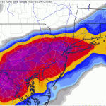
The region from Washington DC to New York is likely to have another half foot or more of snow, and storm totals will be two to three feet with much larger drifts over that area. This snow will taper off this evening over much of the area.
The map…
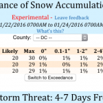
Friday AM Update: Overall the storm has shifted north. Washington DC is still on track to have something close to two feet of snow in the city, more to the west. The predicted snowfall for New York City, the city that eats meteorologists, is increasing, and The City may see a foot or more, with closer to two feet to the northwest. DC will have its most intensive snowfall during the night on Friday, while New York City will have most of its snow falling during the day on Saturday.
With this northward shift, Boston is likely to get more snow too, possibly over a foot. Snow will start there…

