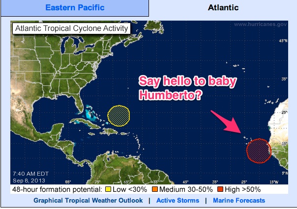
Over the last several days the Atlantic has been very active, producing numerous storm systems that had promise to turn into something. Only one did, Gabrielle, and Gabrielle downgraded to a stormy blob (#1 on the above graphic from the National Weather Service). Gabrielle may well be back as a tropical storm, but there is only a small chance of that. If exGabrielle does turn into something it will most likely go straight north in the Atlantic. The second item is something that the NWS hurricane people have been watching since it was over the Sahara, hinting in their regular updates that something is coming. It isn't that common that a tropical wave gets that much air time while still over West Africa, so I'm thinking this one is for real. The update from the NWS indicates that there is about an 80% chance of this wave (#2 on the graphic) will become a tropical cyclone during the next five days. This storm, as well, would likely track north across the Atlantic.
So, both storms have zero chance of affecting the Gulf of Mexico, and both have a high chance, if they develop into hurricanes, of tracking more or less harmlessly up the Atlantic.
Of course, Sandy tracked up the Atlantic and then made a left turn into New Jersey/New York. I don't think the steering conditions for that happening with either of these storms is in place at the moment, though.
Update: That system off the West African coast now has a 90% chance of becoming a named storm. I believe the next name in line is Humberto:
