
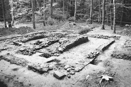
Abandoned fourth century AD settlement. Photo by L. Laüt.
In the June 2007 issue of Ecology, Dambrine et al. have a fascinating article demonstrating that abandoned Roman settlements still affect the local abundance of plant communities. From the abstract (italics mine):
Combined archaeological and ecological investigations in a large ancient oak forest in Central France have revealed a dense network of ancient human settlements dating from the Roman period. We demonstrate a strong correlation between present-day forest plant diversity patterns and the location of Roman farm buildings. Plant species richness strongly increases toward the center of the settlements, and the frequency of neutrophilous and nitrogen-demanding species is higher. This pattern is paralleled by an increase in soil pH, available P, and δ15N, indicating the long-term impact of former agricultural practices on forest biogeochemical cycles. These extensive observations in a forested region on acid soils complement and confirm previous results from a single Roman settlement on limestone. Ancient Roman agricultural systems are increasingly being identified in contemporary French forests; the broad extent and long-lasting effects of previous cultivation shown in this study require that land-use history be considered as a primary control over biodiversity variations in many forest landscapes, even after millennia of abandonment.
One interesting thing is that calcium carbonate leaching from the building's mortar alters the soil pH, and consequently affects nutrient availability. This increases the number of species found close to these settlements.
That's right: mortar that is at least 1700 years old is still determining plant community composition.
Pretty cool.
Soil phosphates are commonly mapped to find ancient settlement sites: byres have a particularly distinct phosphate fingerprint. One of Sweden's richest agricultural provinces was phospate mapped from one end to the other in the early 20th century in order to identify the best land for sugar beets. That map has proved invaluable to archaeological settlement surveys. The largest phosphate blob on the map, for instance, coincides with a huge 1st Millennium settlement that was most likely the region's royal seat.
And a bold tag from the beginning of your post is still determining that comments are all in bold.
Soil phosphates are commonly mapped to find ancient settlement sites: byres have a particularly distinct phosphate fingerprint. One of Sweden's richest agricultural provinces was phospate mapped from one end to the other in the early 20th century in order to identify the best land for sugar beets