speculation
The Geysers Geothermal Power Plant
Eruptions reader (and former hallmate at Oregon State) Ed Kohut sent me a message today pointing out that there is an ongoing earthquake swarm in the area of the Geysers in northern California. Now, I don't know what the normal seismicity is underneath the Clear Lake area and this area is part of the San Andreas fault system, so these earthquake are likely not volcanically related, but I post them here just as a reminder of how difficult it can be to deconvolve these geologic signals.
The Geysers are part of the Clear Lake volcanic region, which is still…
Nyiragongo as seen from Goma, Congo in 2002.
There isn't much to go on so far, but there are indications that an eruption has started at Nyiragongo in the Democratic Republic of Congo. Satellite images has found "thermal anomalies" at the summit and along a 3-km swath of the eastern and western slopes. The report mentions that these could be "fires and /or volcanic material" and more interestingly, noticed at least 6 times since April 10, 2009. From the sound of it, this might be multiple vents or a central summit vent with lava flows going to multiple sides of the volcano. The Volcanism…
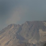
Descabezado Grande, Chile showing increased fumarolic activity in 2009.
Well, if they didn't have enough already between Llaima and Chaiten, another volcano in southern Chile has started erupting. Descabezado Grande (roughly translated: "The Big Beheaded One") has erupted or is showing of eruption (in spanish and NOTE that the picture in the article is of Llaima, NOT, I repeat, NOT Descabezado Grande ... grrr) but details are scant on the actual activity. However, scientists from the SERNAGEOMIN are headed to the area to evaluate the volcano - hopefully the reports are accurate. So far,…
Well, after lamenting the slow volcano news, things are beginning to pick up again. Beyond the news of a potential increase in activity at Anak Krakatau, there are a few other newsworthy bits that have come up:
Mt. Kerinci in Indonesia
Mt. Kerinci in Indonesia is showing signs of eruption. The volcano is the highest mountain on the island of Sumatra, reaching 3,800 m / 12,400 feet and last erupted in March 2008. Its volcanic activity is marked by small (VEI 2) explosions of ash and tephra. Currently, the volcano is experiencing increased tremors and minor explosions that rained ash on a tea…
Anak Krakatau erupting in 2007.
There is a report out tonight that activity might be increasing at Anak Krakatau in Indonesia, however, it is unclear whether it is actually increasing or not. People are evacuating the coastal area of the Sunda Strait to Bandarlampung in fear that a major eruption of the volcano is on the horizon. However, the Volcanology and Geological Disaster Mitigation Center (PVMBG) in Indonesia has not changed the alert status at Anak Krakatau and it remains at 2 of 4 (~Orange Status). The volcano has been erupting almost constantly for the last few years, producing…
Fissure vent eruption from Fernandina in the Galapagos Islands.
In news that comes as a surprise to no one, the current eruption on Fernandina in the Galapagos is having some adverse effect on the wildlife in the Pacific archipelago. Numerous dead fish and sea lions have been seen in the ocean near the actively erupting volcano - now, what exactly is causing the deaths is more speculative. I would imagine with the large plume being produced by the volcano, along with the lava flows reaching the ocean, that volcanic gases and the lava's interaction with the sea water might be the leading…
Busy day so I probably won't get to update much as we're busy hosting Dr. Charlie Bacon, geologist for the USGS, here at UC Davis today. Dr. Bacon has written some seminal papers in his career and is probably the foremost authority of the evolution of Crater Lake/Mt. Mazama (speaking of which, >a new geologic map for the Park was recently released) and the caldera-forming eruption. He's also a really nice guy.
If you want to read some of his papers, you might try these:
Bacon, C.R., Implications of silicic vent patterns for the presence of large crustal magma chambers, in: D.P. Hill, R.A…
Redoubt from Ninilchik, AK. Image courtesy of Calvin Hall.
It has been a few days since we've talked about Redoubt. Well, it might be because the volcano has settled down for the past week, to the point that AVO put the volcano back to Orange/Watch status last week and hasn't had to go back to Red/Warning since. This is not to say the Redoubt is quiet, on the contrary, there is still elevated seismicity, an almost-constant steam/ash plume up to 15,000 feet / 5,000 meters and most importantly, the new dome (below) is still growing near the summit. The system has been actively degassing carbon…
Chaiten erupting on January 19, 2009. Image courtesy of the NASA Earth Observatory.
It is hard to believe that we are less than one month away from one-year anniversary of the beginning of the eruption at Chaiten (and with it, the one-year anniversary of this blog!) The volcano in southern Chile is still erupting away, creating at least 2 dome complexes within the older caldera. These domes have been experiencing periodic collapses, creating block & ash flows, some of which have made it out of the caldera and down close to the ghost town of Chaiten. Along with the block & ash flows,…
Llaima in Chile erupting in 2009.
A quick note to pass along about the ongoing eruption at Llaima in Chile. The eruption did seem to be waning earlier in the week, but the news now is that debris from the eruption is partially blocking the vent. The cone of pyroclastic material (tephra) that has been ejected during the eruption is now overlapping the main crater, potentially blocking part of the vent ... and most people know what happens if you plug up a volcano that is actively erupting - blammo!
The SERNAGEOMIN is not certain that this cone of material (in spanish) will cause a more…
Canlaon volcano, Philippines
Geothermal energy is one of those sources of energy that might be able to solve a lot of the planet's energy problems - heck, the Earth has a lot of heat it is trying to get rid of, so taking that heat and turning into energy seems like an easy (and clean?) way to stop using fossil fuels and the like. Of course, like any supposed panacea, it has its problems.
However, one aspect that gets people are riled is whether drilling into areas of active magmatism might actually cause volcanism. Just in the last few weeks, a controversy was sparked in the Philippines…
Image courtesy of Calvin Hall. Taken 3/28/2009 during an eruption at 10:59 AM3:28 PM.
UPDATE 4/2/2009 at 11 AM Pacific: I'm moving this up from the comments, but Eruptions reader Doug Cole pointed out (and I have no idea how I missed this) that Redoubt has a new webcam! This one is at the DFR seismic station, ~8 miles / 12 km northeast of the volcano. Great views on it today showing the extent of the ash around Redoubt and the steam/ash plume. This view will also be excellent if we get any dome collapse pyroclastic flows (see below).
After a week of explosions and ash fall, Redoubt seems to…
Image courtesy of the Southern California Earthquake Center
I have to admit, I've only been perpherially following the earthquake swarm currently going on in Southern California, near the end of one of the strands of the San Andreas fault out below the Salton Sea (see the bottom of the map above). The "Bombay Beach" swarm (as I'll call it ... beats me what most people are calling it) is being closely monitored by the USGS. However, from what I had heard from a friend of mine with a more structure/tectonics background, looked like tectonic quakes with "beachball focal mechanism solutions"…
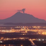
Goma after the 2002 Eruption of Nyiragongo
The activity at Redoubt has captivated a lot of us, but in the grand scheme of things, its eruption are more likely to caused inconvenience and property damage rather than dramatically loss of life (unless something huge and unexpected occurs). However, the same cannot be said if Nyiragongo and/or Nyamuragira (a.k.a. Nyamulagira) in the Congo were to erupt. These volcanoes are close to the city of Goma, a city of nearly 600,000, not including refugees from the fighting in the region. Eruptions of Nyiragongo in 2002 prompted the displacement of 400,…
Image courtesy of AVO/USGS by Ron Beck. Shows an ash plume from Redoubt (tan) on March 26 from a Landsat 5 satellite.
I'll be "off the grid" for the weekend at a wedding, so I thought I'd leave this open for any Redoubt news Eruptions readers hear over the weekend. Feel free to leave comments about the developments up in Alaska.
Currently, AVO reports that seismicity is lower since the eruptions this morning. They indicate that eruptions will likely occur without warning from here on in.
There are also some new articles on how the eruption is affecting air travel, including cancellations of…
Image courtesy of AVO/USGS. Taken by Cyrus Read
Based on the current levels of seismicity over the past 36 hours, AVO has returned Redoubt to Orange/Watch status from Red/Warning. This doesn't mean that the eruption is over, just that things have settled down a bit. Flights to and from Anchorage have resumed as well. You can read the full statement here, but the take-home messages are:
AVO expects this to be like the 1989-1990 dome-building eruptions, although no new dome magma has been seen yet (mostly thanks to poor weather).
Dome collapse will likely generate pyroclastic flows with…
Image by AVO/USGS/Game McGimsey, March 23, 2009
Redoubt has simmered down some today with no new eruptions since yesterday evening. AVO's field crew not only fixed the Hut webcam, but also spotted massive lahar deposits (see above) in the Drift River valley that traveled 35 kilometers downstream and have officials on local and national levels worried about the Drift River Oil Terminal. Funny, it sounds so familiar somehow? As usual, an ounce of planning and thought about locating an oil terminal at the foot of an active volcano would have prevented about 10 tons of problems now.
AVO will be…
The Hut webcam at Redoubt that has a great view of the hydrothermal vents near the 1989-90 domes - and the area where the current eruption is likely to be sourced - is back online. So far, we can see what looks like lahar deposits on the lower left-hand flanks of the volcano in the stream channels (likely formed by the melting of the Drift Glacier) and ash deposits all over the snow. Also, depending on the light and clouds, you can definitely see an ash column coming from the volcano.
Also, AVO is reporting that at 7:41 PM (Alaska time), a new ash column was spotted on radar reaching 60,000…
The Anchorage Daily News has a report that 16 Alaskan representatives got stuck in Anchorage after the eruption started. They were headed to Juneau to vote on Alaska accepting stimulus money ("volcano monitoring" anyone?), but they were on one of the many flights canceled by Alaska Airlines today due to the ash. ADN also have reports of an "ash out" in the coastal town of Skwentna.
AVO is currently reporting that ash doesn't appear on the current radar maps in the Cook Inlet and there are no reports of new ash fall. This suggests that the ash is either staying below 13,000 feet / 4,000…
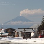
Redoubt on 3/15/2009, from Eagle River overlooking Anchorage. Photo courtesy of Calvin Hall
I'm breaking this out of the comments of the "Redoubt Erupts!" post just to keep things up-to-date.
As of now, we know:
At least 5 explosions have occurred as part of the eruption
Ash has drifted to the NNE and W - both as seen on radar and as reports of ash falling in Skwentna and the Chuitna area - and so far missing populated areas (see above)
The ash cloud is believe to have reached as high as 50,000 feet/15,000 meters - prompting an aviation warning/restrictions and cancellation of flights out…