
by Dominika Heusinkveld, MD, MPH Researchers at NASA and the University of Arizona, among others, are hoping to make real-time air quality forecasting a reality in the next few years. The NASA Health and Air Quality Applied Sciences Team, or HAQAST, is collaborating with health departments, county and state agencies, and university researchers to get the word out about its satellite data. The data, available for free online, can help track air quality indicators, heavy metals in air, dust, and other atmospheric components which can affect human health.
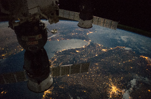 Photo courtesy of NASA Image Library
NASA satellites have been collecting data for years on nitrogen dioxide, ozone, particulate matter, and sulfur dioxide. The time period of available data depends on when the individual satellite was launched. The HAQAST team hopes to encourage local stakeholders to make use of it. NASA HAQAST Team Leader Dr. Tracey Holloway says, “Hopefully when [agencies] see that satellite data and other NASA resources can answer their [public health] questions, they will take advantage of all the amazing satellite and other data available.” A past NASA project, the Air Quality Applied Sciences Team (AQAST), was the genesis of the current HAQAST project. AQAST aimed to increase the utility of satellite data to researchers and public agencies while improving communication with stakeholders such as the public and government officials. “We publish papers in journals but it’s not really percolating into policy,” said Avelino Arellano, Jr., Associate Professor of Data Assimilation and Atmospheric Chemistry at the University of Arizona’s Department of Hydrology and Atmospheric Sciences. The AQAST project was an important way to connect the data to stakeholders. One of the AQAST projects resulted in a brief video with President Obama explaining how satellite data has been helpful in tracking nitrogen dioxide, a common air pollutant. Arellano sees the video as one of the success stories of AQAST. Another was improving communication and relationships between agencies like NASA, the EPA, and NOAA. “AQAST was instrumental in showing how satellites can ‘see’ trends in air pollution, even in areas where no other monitors exist. As a result, the EPA used satellite data in their public report on clean air trends for the first time in 2016,” says Holloway. HAQAST plans to build on those successes with a wider emphasis on human health, says Holloway. Input from satellite data can greatly improve current air quality forecasts, but these are still not accurate on a local scale and require finer resolution to be more useful. “We don’t really have a good forecast for air quality yet,“ says Arellano. For instance, air pollution is worse during rush hour, but many of the older satellites only pass over an area once a day, so the differences in air quality between morning and afternoon rush hour are not seen. A new satellite, called GOES-16, should fill in some of the blanks and provide finer resolution data. According to a NASA website its instruments “can provide a full disk image of the Earth every 15 minutes, one of the continental U.S. every five minutes, and [have] the ability to target regional areas…as often as every 30 seconds.” In addition, more research will be needed to fully utilize the data and to integrate it with human health. “In forecasting I’m not really sure that there’s a connection between what the satellite sees and what you breathe,” Arellano says. “We need to connect studies on air quality and data on air quality to health.” For example, while pollution has been linked to cardiac events (such as heart attacks) and lung disease, more studies need to be done on the relationship between air quality and hospitalization events. These relationships are extrapolated in much of the current research; direct correlations would provide a clearer picture. Arellano would like to see public health agencies and federal agencies such as the National Weather Service utilize the satellite data. He would also welcome collaborations with nonprofit agencies. The main limitation he encounters is lack of connections between researchers and nonprofits. Fortunately, outreach is an important part of HAQAST’s mission. “We have a Twitter account (@NASA_HAQAST), the new website, a semi-monthly newsletter, and even a YouTube channel,” Holloway says. In addition, the team hosts two meetings per year with a variety of local and national agencies. “We’ve found…that listening is the most important part - we need to hear where new information could be helpful… then the scientists on our team work to figure out new ways to answer open questions,“ Holloway says. She encourages interested agencies to contact the team. “Our mission is to serve the public and maximize the benefit of satellite data for health and air quality. ” Want data? Here’s where to get it:
- Worldview: Users can make layered maps from daily, monthly, and yearly data. Good for new users, and user-friendly.
- Giovanni: Users can make maps, map plots, and download data. Also good for new users.
- ARSET: the Appled Remote Sensing Training program. Offers online training on how to use satellite remote sensing data.
- For more advanced users: download the data files for mapping or plotting from https://earthdata.nasa.gov/earth-observation-data/near-real-time. Will require the use of advanced data management software.
Dominika Heusinkveld, MD, MPH is currently a graduate student in the University of Arizona's Environmental Science and Journalism programs. Her interests are environmental health, health communication, and science journalism.
Thanks for Great Article. Well Subscribed the NASA AQAST: Air Quality Applied Sciences Team Youtube channel for video updates..
Thanks again.
Kirod
http://kirod.com